Subject: Dakota and Wyoming
Period: 1872-73 (published)
Publication:
Color: Hand Color
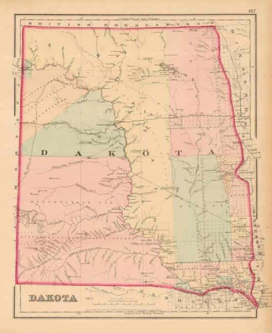
Nice pair of maps for the Dakota collector. The first is Gray's "Dakota," dated 1873, 12.5" x 14.8". It was published in the 1873 edition of "Atlas of the United States" and was copyrighted by G.W. & C.B. Colton. It is a handsome map of the territory with just a few counties in the southeast, and the entire western half filled with Indian Reservations. The huge Buffalo County is rarely seen on maps as it was formed in 1871 and dissolved into numerous counties just two years later. This is a great map of the region issued just sixteen years before statehood.
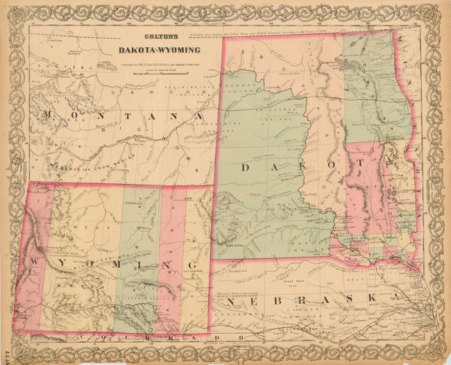
The second is "Colton's Dakota and Wyoming," circa 1872, 16.5" x 13.5". This relatively uncommon and early edition of this map was issued just after Wyoming established its first five counties in 1869, namely Uintah, Sweet Water, Carbon, Albany and Laramie. This is the first atlas map to name Wyoming in the title and to show its correct territorial configuration. It shows only a few settlements outside of the many forts and army posts. The completed Union Pacific Railroad stretches across Nebraska and the southern portion of Wyoming. Fremont's Peak is noted as being "the Loftiest known Summit in this chain." Dakota Territory has only a few counties organized along the eastern border with the balance of the territory in Indian hands but no reservations are named. Again, the short-lived county of Buffalo is shown occupying a huge swath of land laying east of the Missouri River. A string of forts are shown along the Missouri River. Numerous trails and exploration routes are noted including part of the [Pony] Express Route, Fremont and Stansbury's routes, Northern Pacific and Union Pacific Railroads and the Great Route to California and Oregon (Oregon Trail).
References:
Condition: B
First is very good with some light toning along right margin not affecting map. Second has close margins as issued with toning and some chipping at two margins, else very good.