Subject: Arizona, Grand Canyon
Period: 1871 (dated)
Publication:
Color: Black & White
Size:
16.3 x 15 inches
41.4 x 38.1 cm
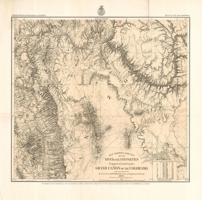
This is the map of Wheeler's epic journey in 1871 up the Colorado River from Camp Mohave (near Needles, Arizona) to Diamond Creek. Published in 1878, it shows the course of the Colorado River from the California line to about midway up the Grand Canyon. Locates Disaster, Portage, Castaway, Cascade, Winding, Roaring, and Long rapids, Vernal Falls, the 1871 Rendezvous, and more. The routes of several prior expeditions are noted including those of Whipple, Sitgreaves, Ives, and Wheeler's of 1869. A table lists the dates and camps of the river party, each keyed to the map. Detailed geographic information makes this a valuable record of western exploration.
References: Wheat [TMW] #1292.
Condition: A
Near fine example on thick paper with a fine impression. A small extra fold at lower left corner and some very light surface soiling in upper margin at left, else fine.