Subject: Western United States - Yellowstone
Period: 1882 (dated)
Publication: Through the Yellowstone Park on Horseback
Color: Printed Color
Size:
18 x 23.8 inches
45.7 x 60.5 cm
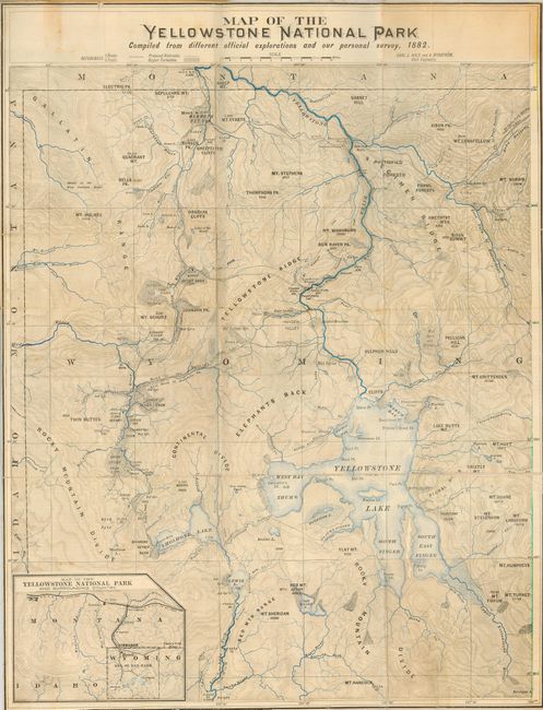
This is a terrific map of the park that contains an abundance of information. It shows waterways in blue, and locates the Upper, Shoshone, Gibbon, and Heart Lake Geyser Basins, Mud Geysers, Mammoth Hot Springs, and much more. This uncommon folding lithograph map of this popular National Park is significantly more advanced and detailed than any other map available to the tourist. Includes an inset titled Map of the Yellowstone National Park and Surrounding Country, which details the road system and the connection to the Northern Pacific RR in central Montana, the most common method of travel to the park. Originally included in George Wood Wingate's book, this example is now linen backed and folding into homemade paper covers. Wingate (1840-1928) wrote the first American book on rifle marksmanship and was a co-founder of the National Rifle Association, of which he was President for twenty-five years. Surveyed and drawn by Carl J. Hals and A. Rydstrom. A most uncommon issue.
References:
Condition: A
The map is generally very good, with a couple small fold intersection splits. The paper covers are toned and slightly frayed.