Subject: Colonial South
Period: 1763 (published)
Publication: Gentleman's Magazine
Color: Black & White
Size:
9.8 x 7.5 inches
24.9 x 19.1 cm
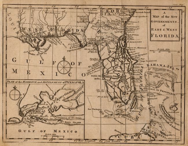
This important map was published in November 1763 just a few weeks following the British acquisition of Florida at the conclusion of the French and Indian War. The region was divided into two British provinces, East and West Florida. The division was along the Apalachicola River; the boundary line for the Royal Proclamation of 1763 that extended from the Ohio River to Florida along the watershed of the Appalachian and Allegheny Mountains. The Proclamation was designed to reduce confrontation between Indians and colonists by outlawing English settlement west of the line. East Florida encompassed primarily the Florida peninsula; West Florida included the Gulf Coast region from the Apalachicola River to the Mississippi River south of the thirty-first degree of latitude. The map locates many settlements, swamps, and rivers. The lower half is bisected by many waterways, giving the appearance that it's made up of numerous small islands. A large inset "Plan of the Harbour and Settlement of Pensacola" provides good detail of the Bay of Sta. Maria Galres (now Pensacola Bay) complete with soundings.
References: Jolly GENT-171; Cumming (SE) #336
Condition: A
Light, overall toning. Narrow margins as issued.