Subject: North America
Period: 1853-56 (published)
Publication:
Color: Hand Color
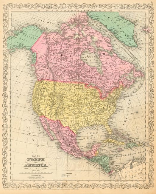
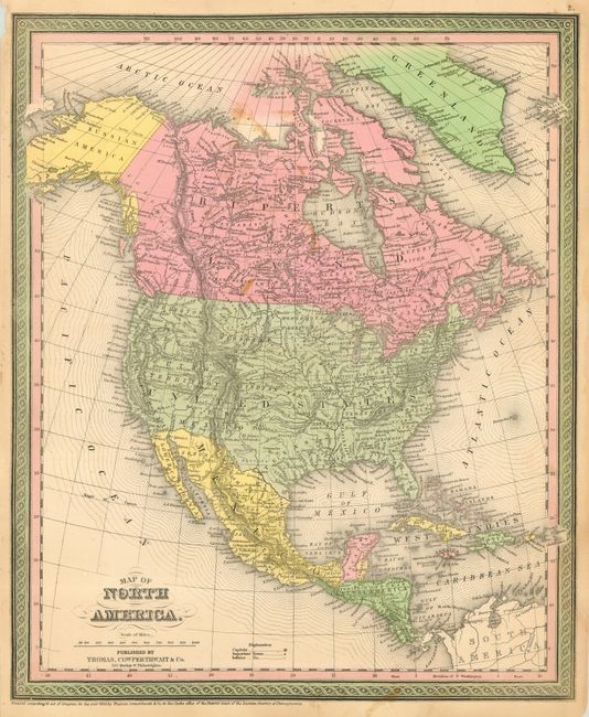
A very nice pair of steel engraved maps detailing North America in the 1850's by two prominent American cartographic companies that appear to have worked closely together. In fact, the address of the two establishments are adjacent: Cowperthwaite at 253 Market Street, and Desilver at 251 Market Street.
The first was published by Charles Desilver, Philadelphia, and is dated 1856. It details early western territorial borders and shows the Gadsden boundary with Mexico, finalized in early 1854. Alaska is here Russian America. Nebraska Territory extends from Kansas Territory to Canada. Washington, Oregon, Utah and New Mexico Territories and the state of California are organized in the west. Good detail throughout including Mexico, Central America and British America. With Desilver's handsome scroll border. (12.8 x 15.8")
The second map features the pre-Gadsden boundary with Mexico. This is the late 1853 edition that includes Washington Territory. A large Missouri Territory extends from Indian Territory to Canada. Dated 1850, but issued circa 1853 by Thomas, Cowperthwaite & Co. of Philadelphia. Surrounded by their distinctive decorative border in original green hand coloring. (12.8 x 15.5")
References:
Condition: A
Both with original coloring, fine impression and original margins. The latter has some very light brown stains from flower pressing and a short repaired tear, only good.