Subject: North America
Period: 1828 (circa)
Publication: New General Atlas
Color: Hand Color
Size:
23.3 x 19.3 inches
59.2 x 49 cm
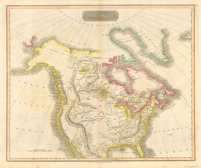
Handsome map of the continent showing the latest discoveries in the western parts of Canada and the United States including those of Mackenzie, Hearne, and Lewis & Clark. Includes Mexico only as far south as Monterey. The Rocky Mountains are shown with an incorrect westward bulge. The Missouri River is projected too far west and there is no Great Salt Lake. Along the western coast are a number of British names: New Norfolk, New Cornwall, New Hanover, New Georgia (in present-day Washington and Oregon) and New Albion (California). Many Indian tribes are named including Snake, Plume, Red, Blue, Wolf, and Beaver.
References: Wheat [TMW] #319.
Condition: B
Nice impression with original outline color. Scattered, light foxing and a couple of tiny holes in the unengraved portion of the upper left corner. Tiny bit of archival tape on verso reinforcing a marginal centerfold separation extending just past the neatline at the bottom.