Subject: World & Continents
Period: 1749 (circa)
Publication:
Color: Hand Color
This is an interesting set of smaller maps with decorative, pictorial cartouches. The continental maps have a block of text to the right keyed to place names.
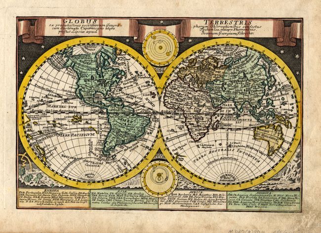
1) Globus Terrestis is a twin hemisphere map surrounded by engravings of the heavens and natural phenomena such as waterspouts, a rainbow, earthquakes, and a volcano. The title is contained in a banner across the top. The map itself shows a fascinating version of North America with a peculiar California barely attached to the continent. New Zealand and Australia are fairly well mapped, although Tasmania is still shown attached to the mainland. Nestled between the hemispheres are depictions of the solar system based on Copernicus and Tycho Brahe. (9.75 x 6.7")
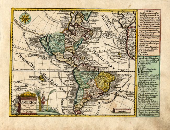
2) America depicts North and South America, with California shown as an island. There is an unusual waterway with three small lakes named Fl. Mortis coming off the Mississippi and emptying into the Mare Vermeio. The Strait of Anian is shown in the Pacific Northwest, flanking a large Terra Esonis Incognita. There are numerous, meticulously engraved place names throughout the map. The title cartouche is surrounded by native figures and products of the Americas. State one of two, dating it to 1749. (9.25 x 6.7")
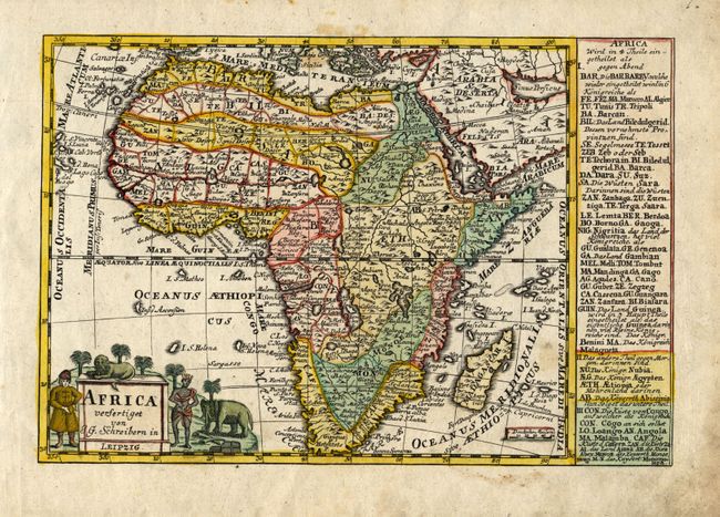
3) Africa is filled with an imaginary interior and place names. The Nile is shown emanating from two lakes, Zaire and Zafftan, south of the equator, and the Mountains of the Moon are nearby. The title cartouche is flanked by a European, African, an elephant and a lion. (9.5 x 6.5")
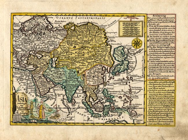
4) Asia. This small map of the continent includes all of South East Asia. Japan appears as a large single island named Imperium Japonicum, incorporating Terra Yedso. Compagnie Land is still shown to the east of Japan. The decorative title cartouche features native peoples and exotic animals. (9.25 x 6.25")
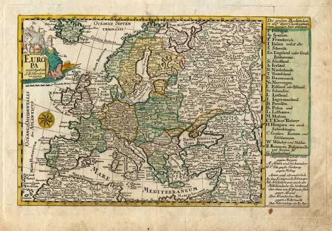
5) Europa is an attractive map of Europe showing the political divisions, which are listed in a column at right. The detail is minutely engraved and includes volcanoes, mountains and other topographical details. The title cartouche features Europa with Mercury and a globe. (9.75 x 6.4")
References: 2) McLaughlin #233; 4) Yeo #137.
Condition: B
All maps generally good with attractive original color. Scattered soil and stains throughout maps, finger soil in right margins. Still a very nice set.