Subject: Exploration and Surveys
Period: 1856 (dated)
Publication: Ex. Doc. No. 6 34th Congress, 1st Session.
Color: Black & White
Size:
9.5 x 11.7 inches
24.1 x 29.7 cm
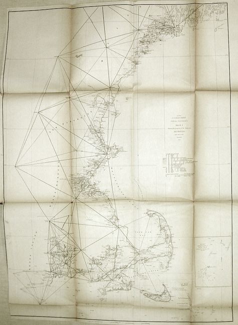
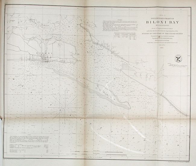
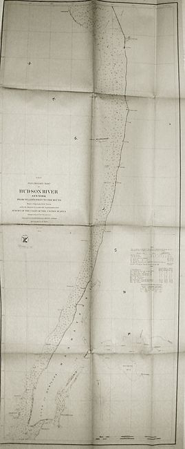
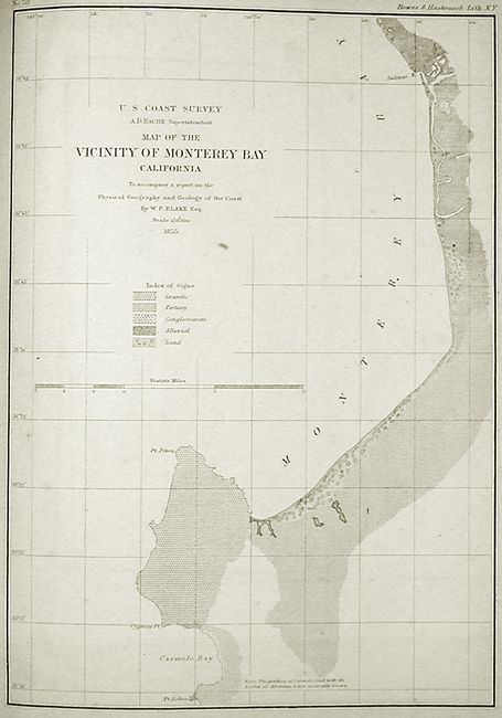
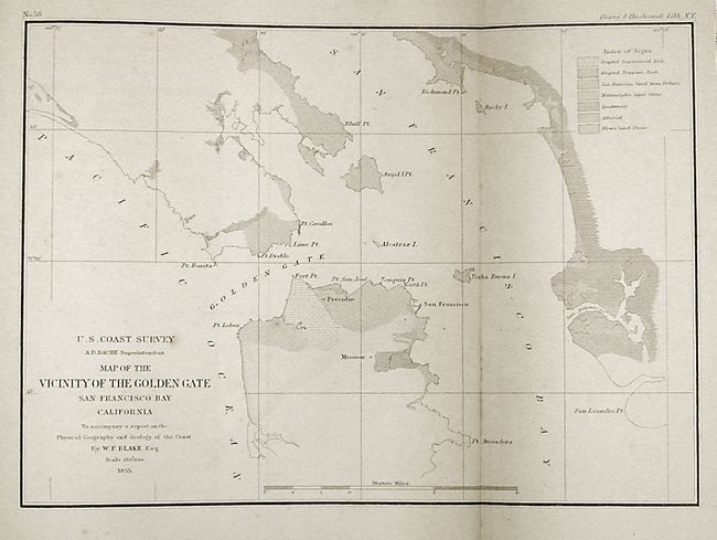
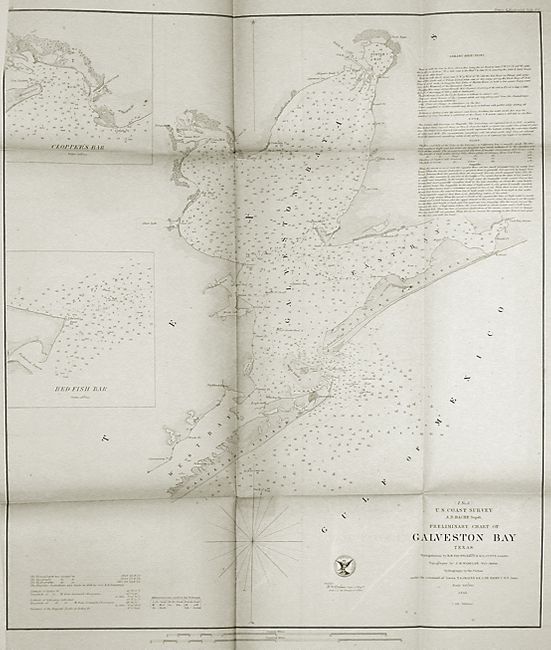
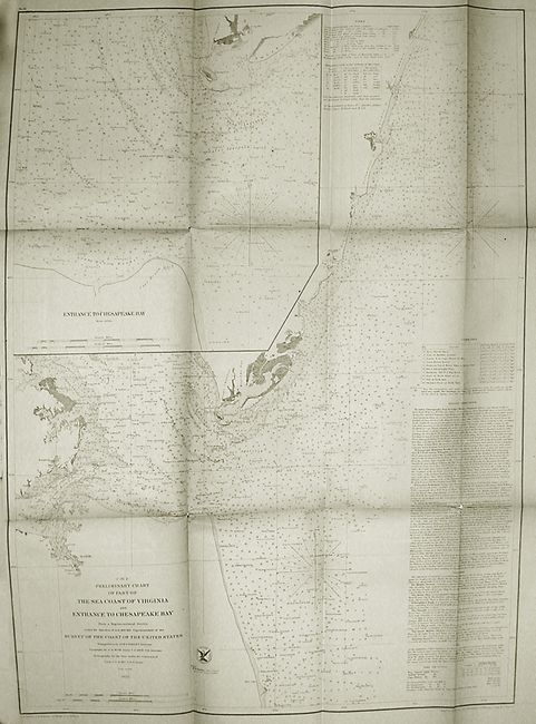
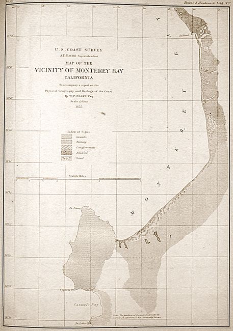
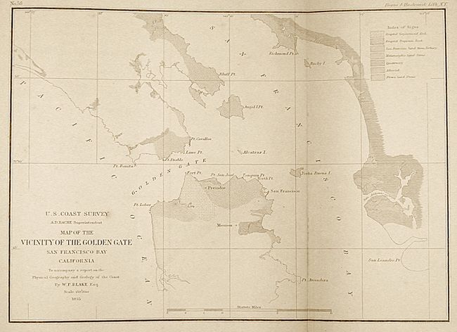
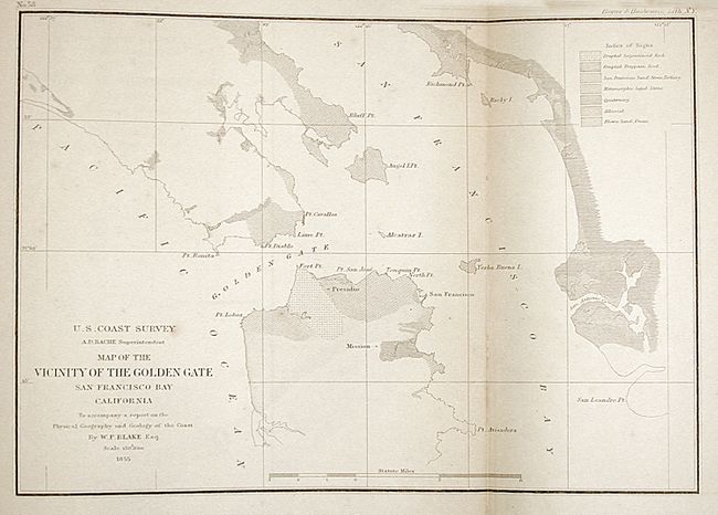
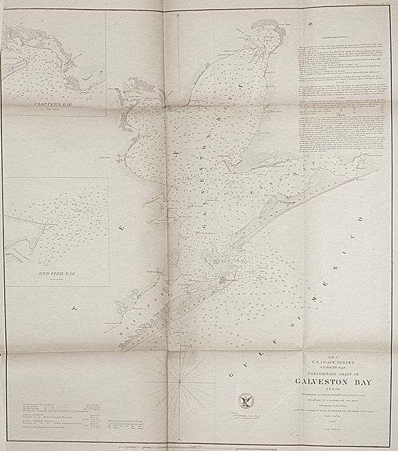
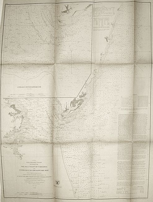
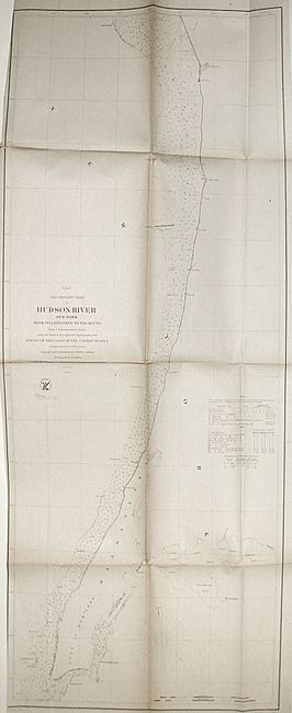
This annual report by the Coast Survey is complete and contains sixty folding charts and sketches. The surveys covered by this report include the Atlantic, Gulf and California coasts. Important charts include Portland (ME) Harbor, Ipswich and Annisquam Harbors, Muskeget Channel, Hudson River, Seacoast of Virginia and Entrance to Chesapeake Bay, Chesapeake Bay, Cape Fear River, Biloxi Bay, Galveston Bay, Vicinity of Golden Gate and Vicinity of Monterey Bay. Complete, xx, 420 pages, Cornelius Wendell, printer. Hardbound in original embossed cloth boards with gilt titles.
References:
Condition: B
Text is generally very good with minor toning on folds of most plates. Approximately one-half of the maps have small binding tears and intersection fold splits. A few charts are loose. Binding with minor shelf wear.