Subject: Atlases
Period: 1717 (dated)
Publication:
Color: Black & White
Size:
5 x 7.5 inches
12.7 x 19.1 cm
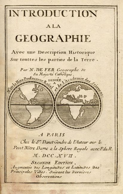
Fine small geography containing maps of the world and continents and a great little title page containing a world map featuring the island of California. Second edition. 6 folding charts, 197 pp. + index. Original calf binding with raised bands and gilt decoration on spine. Contents:
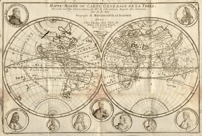
Mappe-Monde ou Carte Generale de la Terre… Double hemisphere world map surrounded by medallion portraits of important explorers. California is depicted as an island, the Great Lakes are not completely formed; nor are Australia, New Zealand and the northeast coast of Asia. Printer's ink error in Arctic, damp/mildew stains and a 2" binding tear.
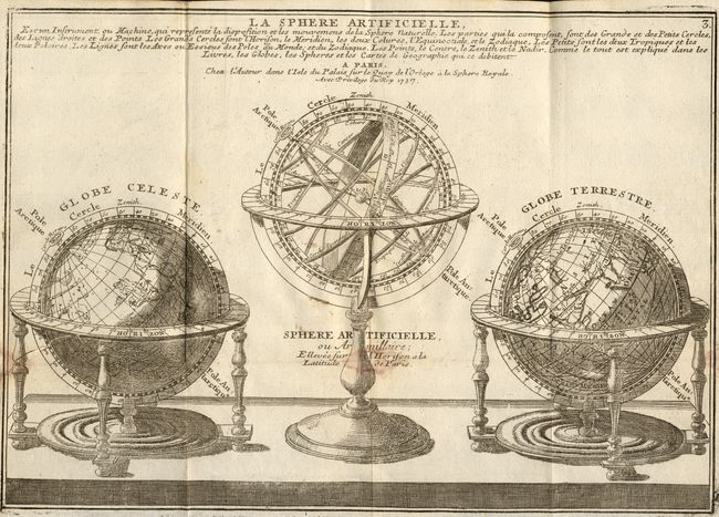
La Sphere Artificielle… A nice engraving of a handsome set consisting of a celestial globe, armillary sphere, and a terrestrial globe. Damp/mildew stains and a 2" binding tear.
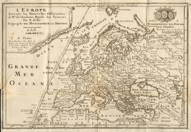
L'Europe Suivant les Nouvelles Observations….. A lovely reduced version of De Fer's large map of Europe. Title in drape-style cartouche and dedication cartouche decorates the map. The map extends to include Asia Minor, the Middle East and the northern coastline of Africa. Light toning at fold intersection, a small stain in cartouche, and 2" binding tear.
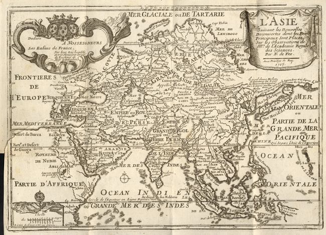
L'Asie Suivant les Nouvelles Decouvertes… Fine map of Asia depicting a continuous land bridge extending from northern Korea and eastern Siberia across to the American Northwest. Finely engraved and embellished with three cartouches. Minor printer's ink smudge in title cartouche and 2" binding tear.
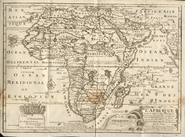
L'Afrique Dressee Selon les dernieres… This map of Africa shows the correct source of the Nile but retains the two large twin lakes south of the Equator. Decorative title and dedication cartouches. Minor damp stains and 1/2" binding tear.
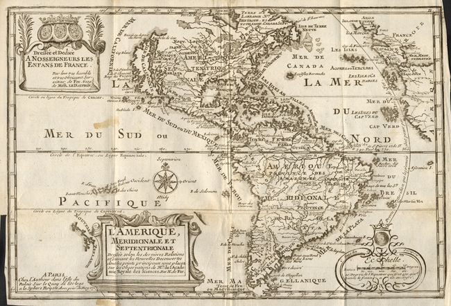
L'Amerique, Meridionale et Septentrionale… Featuring the island of California covering the entire west coast north of the Tropic of Cancer with two large imaginary islands off shore. One of the prominent features in northern Mexico is Les Mine de S. Iean et de Ste. Barbe, the legendary Santa Barbara mines of the Chihuahua-Durango region. There are several large spurious lakes on both continents. A partial coastline of New Zealand appears beside the title cartouche. The map is richly decorated with three cartouches and a compass rose. This is the first state. Faint damp stains and 1" binding tear.
References: America - McLaughlin #135; Africa - Norwich #64.
Condition: B
Contents generally good, condition of maps described above. Binding rubbed with some insect damage and short splits on spine.