Subject: North America
Period: 1782 (circa)
Publication:
Color: Hand Color
Size:
8.8 x 7.5 inches
22.4 x 19.1 cm
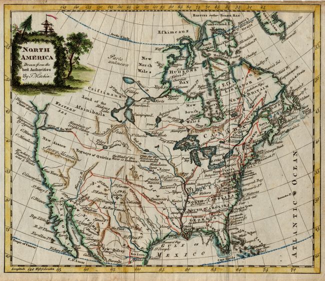
The title cartouche conveniently hides the unexplored northwestern regions on this map of North America. But below the cartouche there is still a wide variety of speculative cartography. The Western Sea has only the western coastline delineated and the entrances are noted as discovered by Juan de Fuca and Aquilar. The River of the West also apparently ties into this vague sea and is connected by dotted line to Pikes Lake and Manlons R.. There is an east-west range of mountains below New Albion labeled the Snowy Mountains. A river in the approximate location of the Colorado is called Martyr's R.. The intermountain region is labeled Teguayo & Quivira and central Canada has a bizarre system of lakes and river. Locates many Indian tribes, Buffalo Meadows, forts, etc. The British colonies are shown with their western boundaries on the Mississippi River.
References:
Condition: B
Issued folding with some extraneous creasing along folds. Narrow top margin, as issued. Toned and soiled margins.