Subject: Egypt
Period: 1700-1840 (circa)
Publication:
Color:
Nice lot of maps showing the Nile River in ancient and modern times.
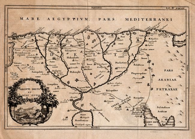
1) Aegypti Delta et Nili Ostia by Cluver, circa 1700 (12 x 8"). Nice little uncolored map that depicts the delta region with ancient place names. The cartouche features a Sphinx and a river god. Some uneven toning, else a crisp impression.
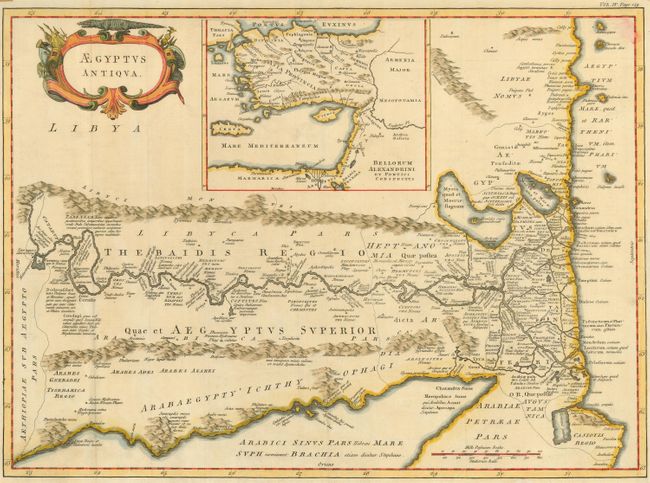
2) Aegyptus Antiqua, anonymous, circa 1700 (19.5 x 14.5"). This map is oriented with north to the right and provides an excellent view of the Nile River valley with ancient place names. A large inset shows the Eastern Mediterranean during the reign of Alexander. Margins trimmed but adequate. Binding trim replaced. Some color displaced in upper right corner.
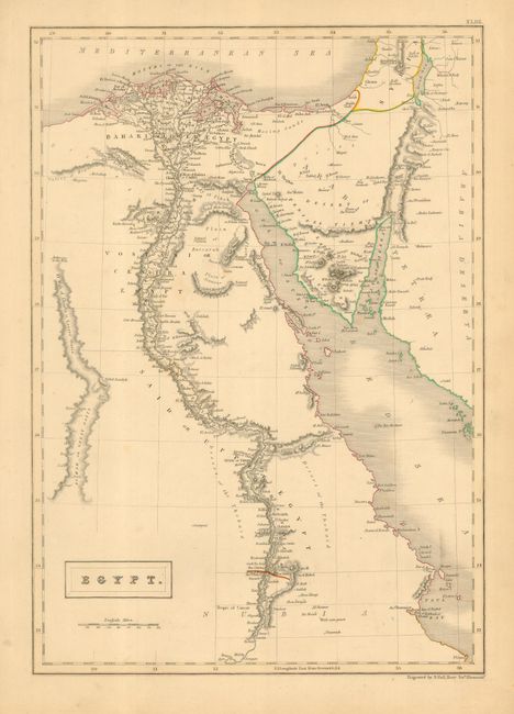
3) Egypt, engraved by S. Hall, London, circa 1840, outline color (10.3 x 14.6"). This map covers the Nile and most of the Red Sea with great detail, including the El Wah or Great Oasis. Lightly toned.
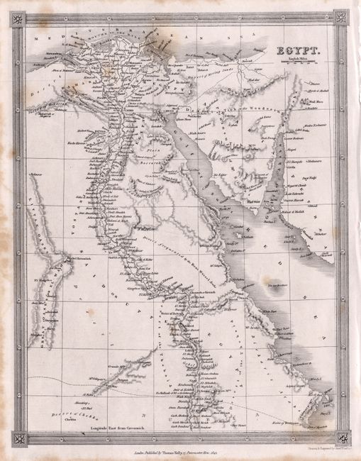
4) Egypt, drawn and engraved by Alexander Findlay and published by Thomas Kelly, London, 1841, uncolored (7.6 x 9.8"). This small map covers the same area as the previous map. Some foxing.
References:
Condition: B
See descriptions.