Subject: Northern Africa
Period: 1853 (dated)
Publication:
Color: Hand Color
Size:
15 x 12.5 inches
38.1 x 31.8 cm
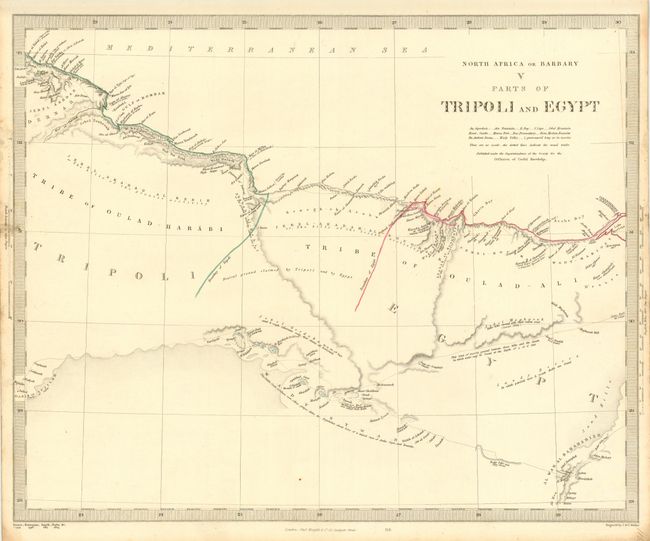
A fine set of steel engraved maps that cover the region from Morocco east to Tripoli and Western Egypt. All follow the coast and are filled with fascinating information and details. All measure approximately as noted above. Keyboard style borders.
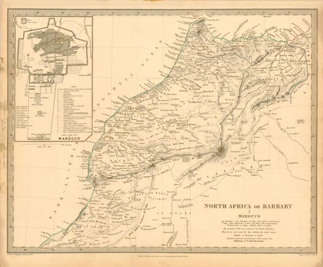
I Marocco includes a large and detailed plan of the walled city of Morocco (Marrakech) that locates eleven important buildings and twenty-six mosques.
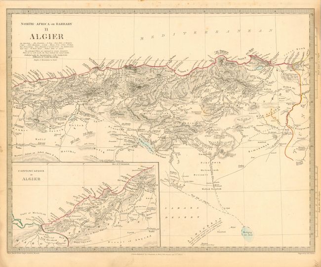
II Algier shows detail of the Mediterranean coast and includes a continuation of Algiers in an inset.
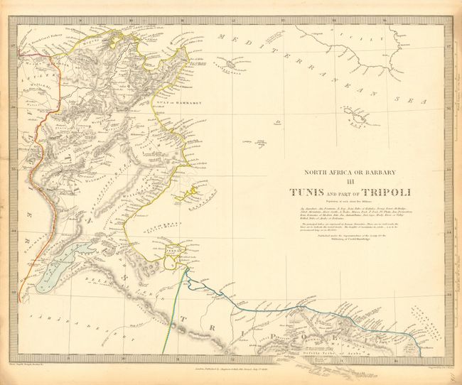
III Tunis and Part of Tripoli shows a portion of Tunisia, Algeria and Libya centered on the Golphe de Gabes. A French Coral Fishery is noted at upper left.
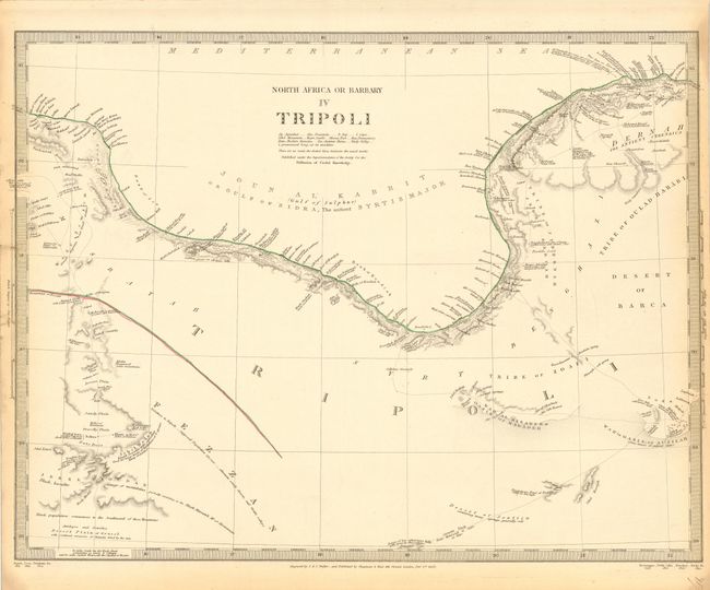
IV Tripoli shows Libya's Gulf of Sidra, here also noted as Gulf of Sulphur. Caravan routes are shown in the interior with interesting notations concerning the wildlife and inhabitants of the region, e.g., "Desert Plain of Gravel with scattered carcasses of Animals dried by the sun."
V Parts of Tripoli and Egypt describes the border area between Libya and Egypt on the Mediterranean, including a buffer zone noted as "Neutral ground claimed by Tripoli and by Egypt."
References:
Condition: A
Good impression and coloring with original margins. Some light marginal toning.