Catalog Archive
Auction 117, Lot 737

"Terre Sainte Moderne que les Turcs ... [on sheet with] Descriptio Acurata Terrae Promissae Per Sortes XII…", Fer, Nicolas de
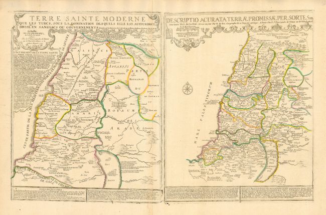
Subject: Holy Land

Period: 1720 (dated)

Publication: Atlas Recueil de Cartes Geographiques .…

Color: Hand Color

Size:
28.5 x 18 inches
72.4 x 45.7 cm
Download High Resolution Image
(or just click on image to launch the Zoom viewer)

This large, uncommon sheet contains two maps. On the left is a 'modern' map by Nicolas de Fer that shows the region under Turkish rule and divided into provinces. On the right is a map by Philippe de la Rue that depicts the Promised Land divided into the twelve tribes. The map provides a wealth of information, both in the maps and in the accompanying French text. This edition was published by Guillaume Danet.

References: Pastoureau, FER II C [88].

Condition: A

Original outline color. Bit of minor soil, still very good.

Estimate: $750 - $900

Sold for: $400

Closed on 12/6/2006

Archived