Subject: Western Hemisphere
Period: 1552 (published)
Publication: Geographia
Color: Black & White
Size:
13.5 x 10 inches
34.3 x 25.4 cm
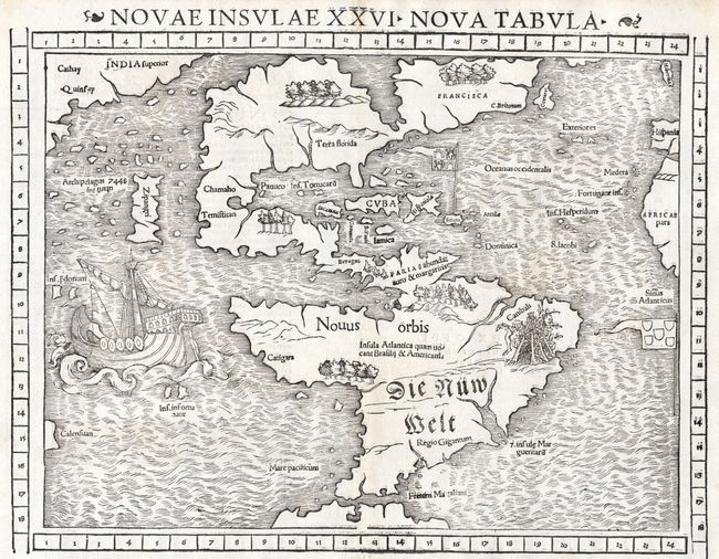
This is one of the most important 16th century maps of the New World, credited with popularizing the name America. North America is very oddly shaped with no California and Zipangri (Japan) is shown only a short distance off the western coast. In the east, the land is nearly bisected by a body of water, known as the Sea of Verrazzano. The Yucatan is still shown as an island and the lake at Temistitan is connected to the Gulf of Mexico. South America has a large bulge in the west, the Amazon River is very short and cannibals inhabit the continent, shown with the name Canibali next to a gruesome vignette with human limbs. The map is very decorative with Magellan's surviving ship Victoria appearing in the Pacific. The flags of Spain and Portugal depict their respective spheres of influence in the New World. Burden - sixth state; the only edition to contain a printed border of bars representing latitude and longitude. Latin text on verso.
References: Burden #12; Kershaw #5.
Condition: A+
Sharp impression printed on high quality paper. Bit of faint foxing in margins, still fine.