Catalog Archive
Auction 117, Lot 439

"Carte des Grandes Routes d'Angleterre, d'Ecosse, et d'Irlande", Robert de Vaugondy, Gilles

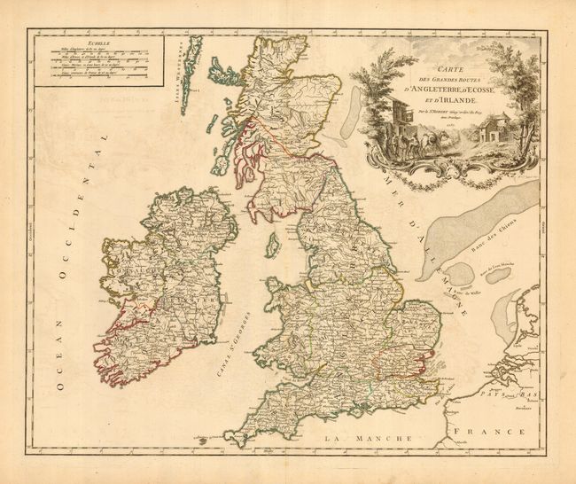
Subject: Britain - Postal Routes

Period: 1757 (dated)

Publication: Atlas Universel

Color: Hand Color

Size:
22.8 x 18.5 inches
57.9 x 47 cm
Download High Resolution Image
(or just click on image to launch the Zoom viewer)

Handsome and detailed map of the mail roads through England, Scotland and Ireland. The finely engraved cartouche depicts a mail carrier mounting his horse outside a country inn. First state of this decorative map with Bellfart instead of Belfast.

References: Pedley #45.

Condition: A

Very good with original outline color and some light offsetting. Toning at edges of wide, original margins.

Estimate: $300 - $500

Sold for: $220

Closed on 12/6/2006

Archived