Subject: Southwestern United States & Mexico
Period: 1782 (dated)
Publication: Political Magazine
Color: Black & White
Size:
14.5 x 11 inches
36.8 x 27.9 cm
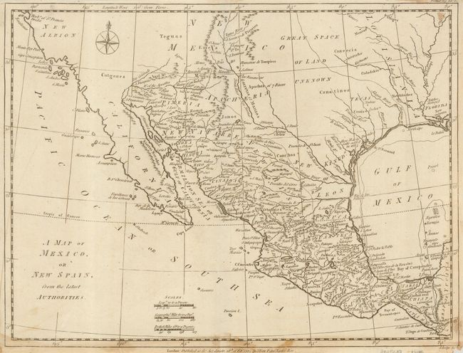
Fascinating little map focused on that part of Mexico and that part of the Southwest that would become Texas, California, Arizona and New Mexico. Tecas is named for Texas, with the region above labeled Great Space of Land Unknown. On the Mississippi River, there is a note of Natches destroy'd, relating to the decimation of the Natchez Indians by the French in 1732 in retaliation for an attack on their garrison. Santa Fe is noted on the map as Sta Fe and New Orleans is shown at the far east of the map.
References: Jolly POL-46.
Condition: B
Generally good with some staining along the bottom of the map with a little spot on top. Narrow (1/4-1/8") margins with chip in bottom margin affecting engraver's imprint.