Catalog Archive
Auction 117, Lot 348

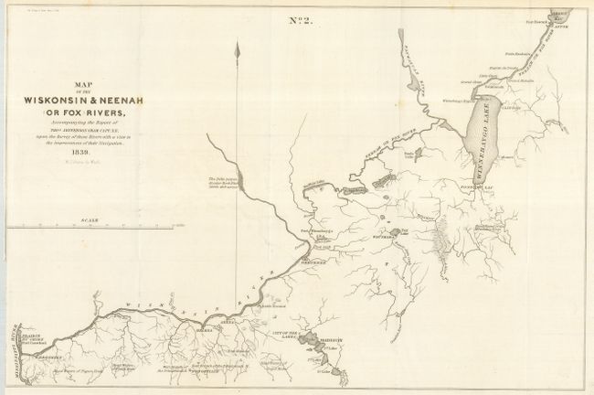
"Map of the Wiskonsin & Neenah (or Fox) Rivers, Accompanying the Report of Thos. Jefferson Cram, Capt. T. E., under the Survey of Those Rivers with a View to the Improvement of Their Navigation", U.S. Government

Subject: Wisconsin

Period: 1839 (dated)

Publication: Doc. 318, 26th Cong. 1st Session

Color: Black & White

Size:
17.2 x 11.4 inches
43.7 x 29 cm
Download High Resolution Image
(or just click on image to launch the Zoom viewer)

This map is from a series of maps that explored the planning of a safe waterway from Green Bay to the Mississippi River. This map shows the lakes and waterways along the way, including those around Madison and the City of the Four Lakes. The lakes are here merely called 1st Lake, 2nd Lake, and so on. Locates Fort Howard, the Head Waters of several rivers and creeks including the Milwaukee and Platte rivers, and much more.

References:

Condition: A

Folded map with closely trimmed binding side as issued, missing a bit of the neatline on that side. Scotch Conservation and Preservation Tape #888 closing a tear on the verso. Otherwise near fine with clean, strong paper.

Estimate: $120 - $170

Sold for: $90

Closed on 12/6/2006

Archived