Subject: Oregon, Portland
Period: 1892 (published)
Publication: H. Ex. 38, 52nd Cong., 1st Sess.
Color: Black & White
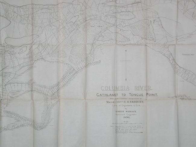
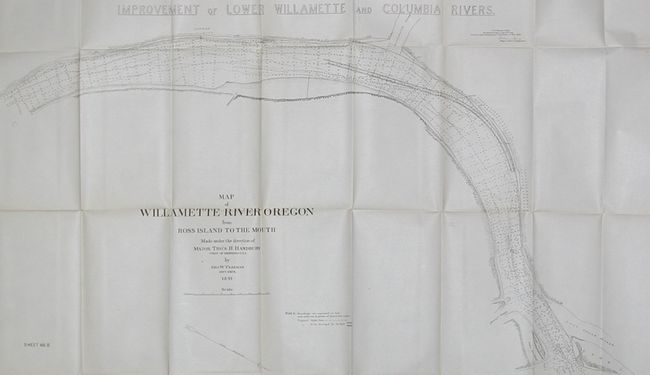
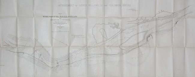
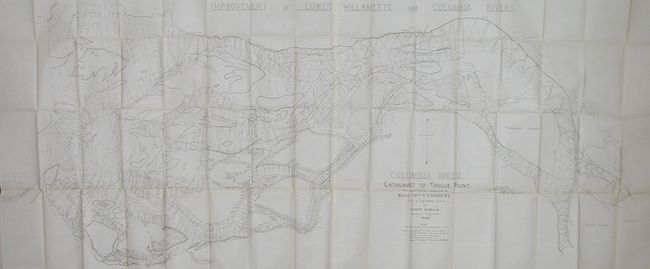
Three large folding maps with the same main title that provide in great detail the plan to dredge the rivers to make Portland more accessible to larger ships. Major Handbury supervised the survey and published the 1892 report proposing the creation of a 25 foot deep ship channel from Portland to the Pacific Ocean at the treacherous Columbia Bar near Fort Stevens. Most of Handbury's recommendations were not implemented for a couple of decades. These highly detailed maps are filled with soundings and other navigational information. Each map has a second title as noted below.
1) Map of the Willamette River Oregon from Ross Island to the Mouth Made under the Direction of Major Thos. H. Handbury by Geo. W. Freeman…1891. Sheet No. I. The map shows a portion of the Columbia River within today's Portland from Ross Island downstream to Saint John. Good detail of Swan Island, Waud's Bluff; locates ship yards, mills, Uild's, Kittredge's and Doane's lakes, and much more. Shows three scissor bridges across the Columbia, the North Pacific Terminal Grounds, and a street grid along the banks with all streets named. (53 x19")
2) same title, Sheet No. II. Details the river from just down stream of Saint John, past Linton and the Willamette Slough to Coon Island and Pearoy's Slough. (53x19")
3) Columbia River, Cathlamet to Tongue Point…by Robert Warrick…1890 This map covers the Columbia River from Puget Island to Tongue Point, which is on the eastern side of Astoria just above Navy Heights. Locates Miller Sands, Marsh Island and Creek, Swenson's Landing, Snag Island and much more. (68.8 x 26.8")
References:
Condition: A
Very nice condition considering the size and age of these maps. Hint of fold toning and the occasional fold intersection split.