Catalog Archive
Auction 117, Lot 268

"[Lake St. Clair and delta of St. Clair River]", U.S. Government
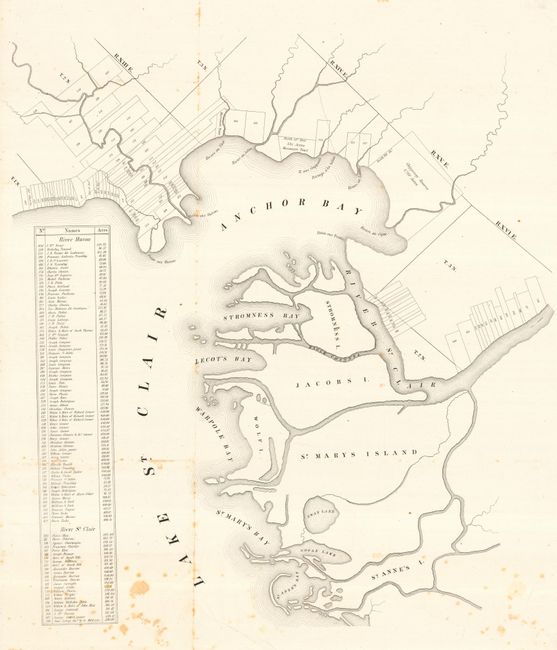
Subject: Michigan

Period: 1830 (circa)

Publication:

Color: Black & White

Size:
24 x 28.5 inches
61 x 72.4 cm
Download High Resolution Image
(or just click on image to launch the Zoom viewer)

This is an interesting map of the delta of St. Clair River and its waterways. Most importantly, the map delineates many private land parcels along the Rivers Huron and St. Clair. The panel at left gives the names of ninety-nine landholders with the acreage for each parcel, all keyed to the map. Locates the bays of Anchor, Stromness, Lecot's, Warpole, and St. Mary's Bays, plus numerous islands and lakes. Also shows the Chippoway Reserve and the 534 acres of the Macoonses's Tract.

References:

Condition: B

Issued folding, now pressed and backed with archival tissue. A little scattered foxing.

Estimate: $100 - $140

Sold for: $95

Closed on 12/6/2006

Archived