Subject: California - Rialto
Period: 1887 (dated)
Publication:
Color: Hand Color
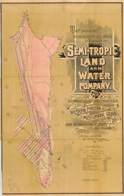
Really fascinating pair of linen backed maps of the town of Rialto, as it was being created in 1887 from the western portion of the Muscupiabe Grant. Both were surveyed and drawn by Burr Bassell for the developer, the Semi-Tropic Land and Water Company. Bassell is better known for his surveying work for the railroads. The maps both show Riverside Avenue, Sycamore, Eucalyptus, Acacia and Pepper Street. They both bear the stamp of the Fontana Development Company, Rooms 302-304, Tajo Building, N.W. Cor. First and Broadway, Los Angeles, Cal. These maps were made when San Bernardino County was at it's largest size, before the creation of Orange and Riverside counties.
1) Map Showing Subdivision of Lands Belonging to the Semi-Tropic Land and Water Company … San Bernardino County, California, Surveyed August 1887, by Burr Bassell.This is a beautiful lithograph with incredibly decorative script. There are manuscript notes from where it was used to survey for the town with notes of iron posts being placed and also signed by a witness. This map shows the initial plat plans and land claims at the time. It also shows Lytle Creek and Cajon Wash and locates the first schoolhouse. Contemporary manuscript on map notes that this map was recorded October 20, 1887. (24.8 x 39")
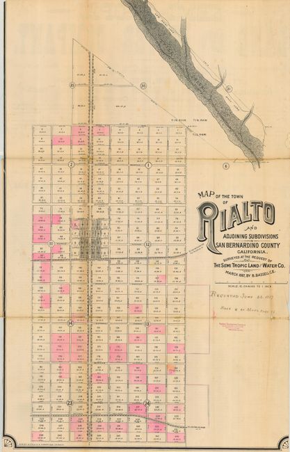
2) Map of the Town of Rialto and adjoining Subdivisions in San Bernardino County, California. This map is an enlarged portion of the lower left portion of the previous map, showing Lytle Creek, on a scale of 10 chains to one inch. It covers a square area bordered by Baseline Road at the top, Lilac Avenue on the left, the Southern Pacific Railroad at the bottom and Pepper Avenue on the right. This map was recorded June 22, 1887 (23 x 36.5").
This great pair of working maps was used in the field as seen by the various manuscript notations and are in remarkable condition considering this usage. Important and historical maps that belong in a good collection of the region.
References:
Condition: B
Linen backed and folding. Both with close trim at left, nearly to neatline on the former and into neatline on the latter.