Catalog Archive
Auction 117, Lot 198

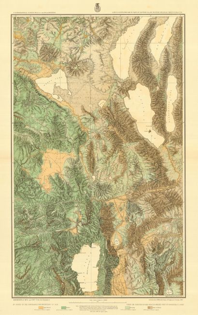
"Atlas Sheets No. 47 (B) 7 47 (D). Land Classification Map of Parts of Eastern California and Western Nevada", Wheeler, George (Lt)

Subject: Western United States

Period: 1879 (dated)

Publication: Geographical Surveys West of 100th Meridian

Color: Printed Color

Size:
13 x 31 inches
33 x 78.7 cm
Download High Resolution Image
(or just click on image to launch the Zoom viewer)

This colorful sheet is from Lieut. Wheeler's epic expeditions to correctly map the topography of the western United States, which took place from 1869-1879. This map is from his travels of 1876 and 1877, and shows the region around the California and Nevada Border. The map describes Lake Tahoe, Washoe Lake, Pyramid Lake, Honey Lake and Winnemucca lake. Donner Peaks and Donner Lake are shown near Truckee, as well as other towns in this part of the Sierras.

References:

Condition: B

Near fine with a centerfold separation just into map about 1". Very easy to repair.

Estimate: $180 - $250

Sold for: $130

Closed on 12/6/2006

Archived