Subject: Western United States
Period: 1847 (dated)
Publication: Olney's School Geography
Color: Hand Color
Size:
17.3 x 10.2 inches
43.9 x 25.9 cm
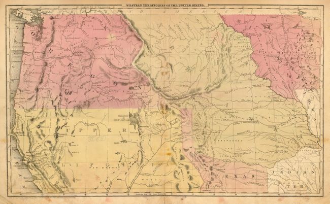
This is a map of the transitional American West. Oregon Territory is massive, stretching all the way from the Pacific to the Rocky Mountains and meeting up with an extension of Texas' panhandle, which goes through present day Denver. Upper California reaches across to Texas, and Nebraska Territory extends from Canada's border down to Texas and Indian Territory. Minnesota is a large territory as well, as the Dakotas have yet to be formed. A Mormon settlement is noted on the Great Salt Lake - this is probably one of the earliest maps to note that fact, as they had just settled in this region in 1847.
References:
Condition: C
Original hand coloring. Stains along centerfold, and at margins. Centerfold separated just into map, faint pencil in map. Pencil notations on verso.