Subject: Railroad Atlas - Pennsylvania
Period: 1881 (dated)
Publication: Pennsylvania R.R. Company
Color: Printed Color
Size:
29.8 x 21 inches
75.7 x 53.3 cm
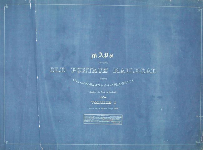
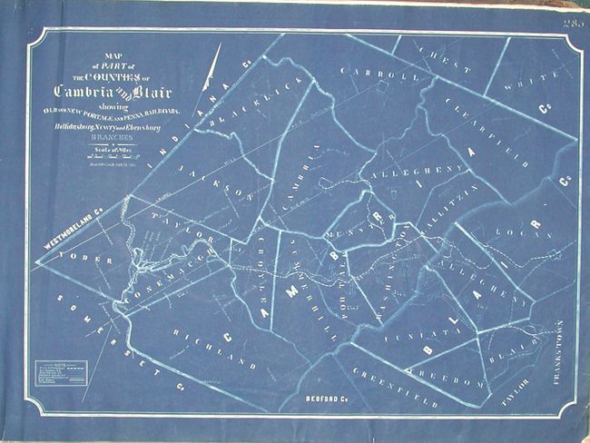
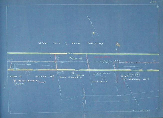
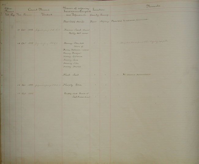
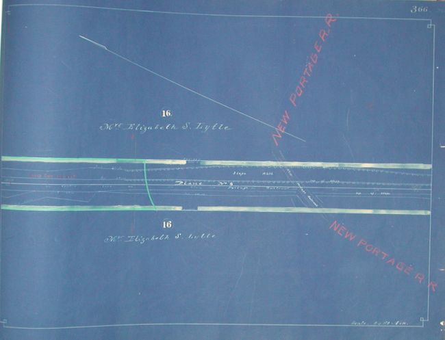
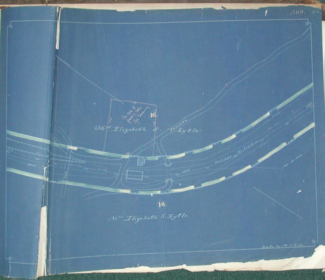
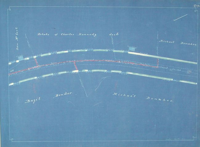
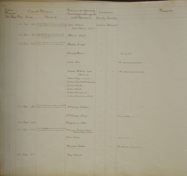
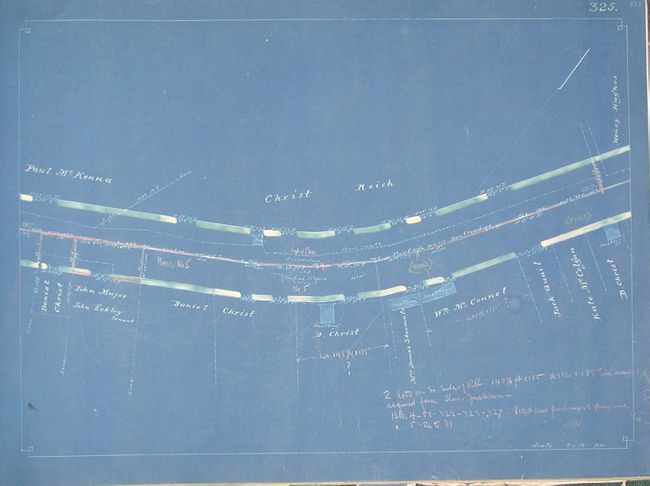
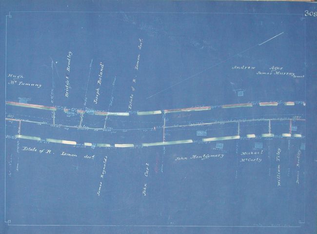
This is a remarkable, working document that the Pennsylvania R.R. used to track the progress of lawsuits brought against private landowners along the route. The 86 large maps are all printed as cyanotypes with hand inking of individual properties to indicate the status of the law suits. The purpose of the atlas is to show all "lands belonging to the Portage Railroad" in one ink color, and "the portions for which suits have been brought and no decision reached are indicated" by a red colored box, and finally those suits rendered in favor of the Pennsylvania R.R. Co. are indicated by blue boxes, all hand drawn. The maps have a good amount of manuscript lettering to add additional information including property owner's names, references to other pages, and the hand applied coloring to indicate the status of the lawsuit by property. Further, each map has facing it a similar sized ledger sheet with hand written information on each property including the owner, status of any suit, and other information. At the front of the atlas is a 4-page manuscript Alphabetical Index listing all property owners and the related map number. The first map is a general "Map of Part of the Counties of Cambria and Blair showing Old and New Portage and Penna. Railroads. Hollidasburg, Newry and Ebensburg Branches." Cyanotypes came into common usage in the 1870's as an early photo-reproduction process known for its resistance to fading. Folio atlas, hardbound in brown cloth with leather gilt label, 86 maps and numerous ledger sheets. A rare railroad atlas and document that is probably one of a kind.
References:
Condition: B
Covers tattered and rough, front cover separated, rubbed and bumped, spine missing. Maps generally very good, first few pages a little rough.