Catalog Archive
Auction 116, Lot 86

"A New General Map of America. Drawn from several Accurate particular Maps and Charts and Regulated by Astronomical Observations", Bowen, Emanuel
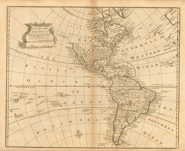
Subject: Western Hemisphere

Period: 1757 (circa)

Publication: A Complete System of Geography

Color: Black & White

Size:
17 x 13.8 inches
43.2 x 35.1 cm
Download High Resolution Image
(or just click on image to launch the Zoom viewer)

A detailed map of the Americas that extends to include the Solomon Islands. The Pacific Northwest is left open, completely blank and labeled Parts Undiscovered. The coastline stops around the area of Alaska with the notation "The Supposed Straits of Annian." The British colonies are shown east of the Mississippi and the only settlements named in the West are Cenis in Texas, Santa Fe and Amarillo in New Mexico, and Casa Grande in Arizona. A very large Lake Superior is shown to contain several islands. A decorative cartouche covers the North Pacific.

References:

Condition: B

Toned along centerfold and some spots mostly in margins. Dark impression on hand laid paper with fleur-de-lys watermark.

Estimate: $250 - $325

Sold for: $160

Closed on 9/20/2006

Archived