Subject: Africa - Northwestern
Period: 1830-68 (dated)
Publication:
Color:
An interesting group of maps created by French explorers, including a fine plan of present day Marrakesh.
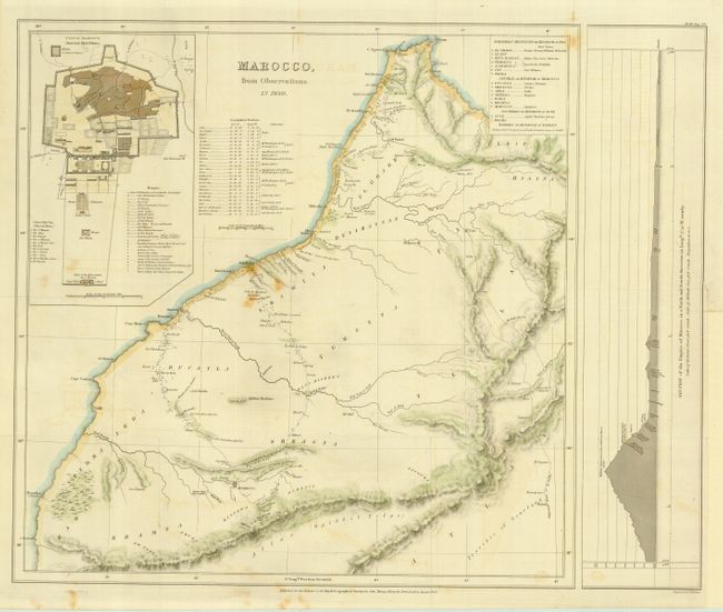
1) Marocco, from Observations in 1830. Published for the Journal of the Royal Geographical Society by John Murray, London, 1831. Hand colored. Slight foxing. (18 x 14.6")
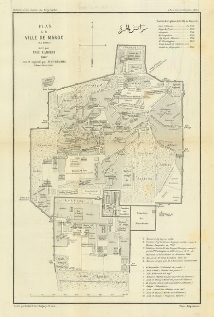
2) Plan de la Ville De Maroc (La Rouge), Paul Lambert, 1867, Bulletin de la Societe de Geographie [1868] Paris. Black/white. Faint foxing. (8 x 12.2")
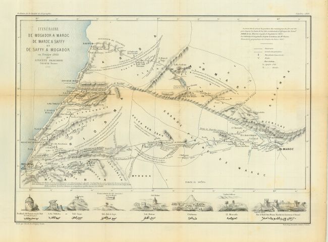
3) Itineraire De Mogador A Maroc De Maroc A Saffy et De Saffy A Mogador en Fevrier 1868, Auguste Beaumier Consul de France,1868. Hand colored. Faint toning. With vignettes along bottom of important places named in both English and Arabic lettering. (15.9 x 11.1")
References:
Condition: B
First with a few foxing spots. The second also with a few very faint foxing spots, near very good. The third is lightly toned along one fold.