Catalog Archive
Auction 116, Lot 715

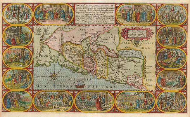
"Tabula Geographica in qua Regiones Cananaeae, et Locorum Situs Prout ea tempore Christi, et Apostolorum suerunt de integro describuntur, ac suis Limitibus distinguntur Auctore, D.R. M. Mathew", Plancius/Cloppenburg
Subject: Holy Land

Period: 1643 (circa)

Publication:

Color: Hand Color

Size:
19.5 x 11.5 inches
49.5 x 29.2 cm
Download High Resolution Image
(or just click on image to launch the Zoom viewer)

Very graphic map from a Dutch Bible depicting the land of Canaan. Fifteen vignettes containing Biblical scenes illustrating the life of Christ surround the map. The map is nicely detailed and is decorated with a strapwork scale cartouche, sailing ship and a compass rose. Second state with D.R.M. Mathes added to imprint. Dutch text on verso.

References: Poortman & Augusteijn #80.

Condition: A

Fine impression and attractive later color. Good side margins, which is unusual with Bible maps.

Estimate: $1,000 - $1,200

Sold for: $550

Closed on 9/20/2006

Archived