Subject: Mediterranean
Period: 1828 (dated)
Publication:
Color: Black & White
Size:
72 x 32 inches
182.9 x 81.3 cm
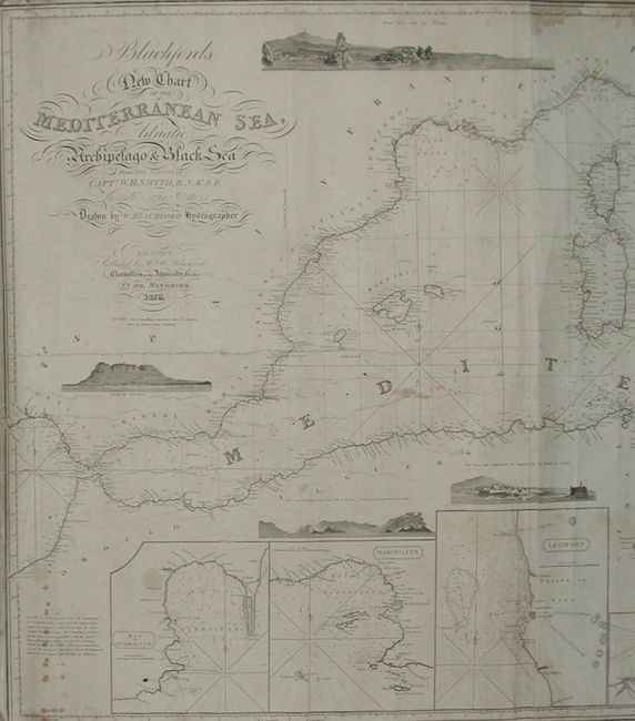
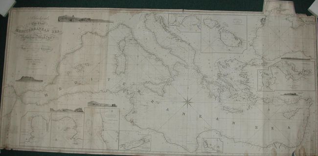
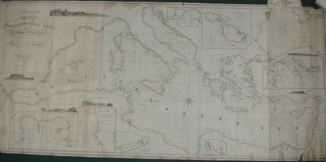
A large, blue-backed sea chart is from the surveys of Admiral Smyth. The magnificently detailed chart extends from the Straits of Gibraltar to the Holy Land, here labeled Syria, and north to show all of the Adriatic and Black Seas. It also includes the Crimea with a pasted on tab that unfolds to complete the northern portion of the Black Sea and its source river. Numerous large inset plans surround the map: Alexandria, Leghorn, Marseilles, Bay of Gibraltar, Harbour of Corfu, Gulf of Smyruna and the Strait of Scio, and Malta and Gozo. Several vignettes include a sea-view of Mount Etna and the Cyclops, Rock of Gibraltar, Coast of Barbary, The Town and Lighthouse of Augusta in the Island of Sicily, and two others. It has very decorative titling in Victorian style lettering. This separately issued chart was prepared by the British chart maker Blachford and the son-in-law of John Hamilton Moore who often assisted Blachford in the publication of these charts. Moore earlier authored the popular New Practical Navigator which inspired Bowditch's New American Practical Navigator. A seldom seen chart that is rarely offered.
References:
Condition: B
A generally very sound example with occasional scattered foxing or surface soiling, some marginal staining, a few short tears and occasional marginal roughness. All in all, a nice example for a map this size that was designed for use at sea.