Catalog Archive
Auction 116, Lot 604

"Das Konigreich Preussen nebst dem Polnischen Antheil", Probst, Johann Michael
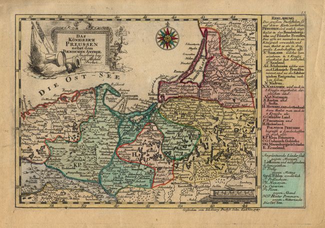
Subject: Poland

Period: 1787 (dated)

Publication: Atlas Minor ex Tabulis Geographicis

Color: Hand Color

Size:
9.8 x 6.5 inches
24.9 x 16.5 cm
Download High Resolution Image
(or just click on image to launch the Zoom viewer)

Scarce, small map based on the cartography of Johann Schreiber. It covers the northern part of Poland between Torun and the Baltic Sea and includes Kaliningrad. The map is adorned with a military-themed cartouche, compass rose and distance scale cartouche. At right is a German text panel describing the political divisions. Engraved by Johann Georg Probst.

References:

Condition: A

Good impression and original color. Lightly toned.

Estimate: $140 - $180

Sold for: $100

Closed on 9/20/2006

Archived