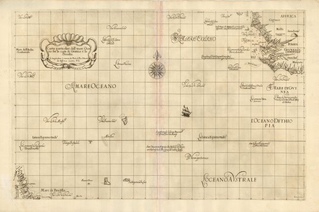
Subject: South Atlantic Ocean
Period: 1646 (circa)
Publication: Dell Arcano Del Mare
Color: Black & White
Size:
29.5 x 19 inches
74.9 x 48.3 cm
This lovely sea chart is from the first atlas to print all maps on Mercator's Projection, the first to show winds, currents and magnetic deviation on its maps, and the first atlas of sea charts by an Englishman. This chart covers the South Atlantic from the Guinea coast of Africa to the Brazilian coast. Dudley, a skilled mathematician and navigator, was exiled from England and settled in Florence where his atlas was published. The chart, beautifully engraved by Antonio Lucini, is embellished with a title cartouche, large compass rose, a sailing ship and graceful calligraphy. Two sheets, joined, as issued.
References: Phillips (A) # 457, Vol. 3, No. 64.
Condition: B
Fine impression, toned along joint with some pastel applied to lessen the toning.