Catalog Archive
Auction 116, Lot 326

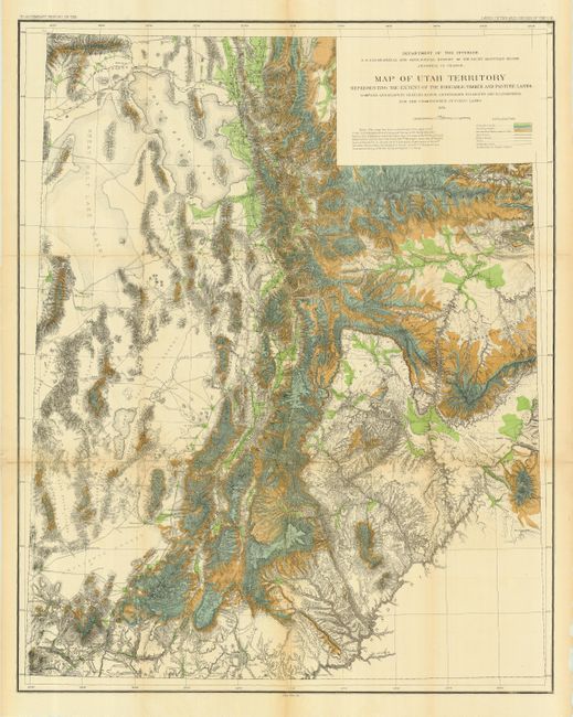
"Map of Utah Territory Representing the Extent of the Irrigable, Timber and Pasture Lands", U.S. Department of Interior
Subject: Utah

Period: 1878 (dated)

Publication: HR Doc 73, 45th Cong., 2nd Sess.

Color: Hand Color

Size:
28.5 x 36 inches
72.4 x 91.4 cm
Download High Resolution Image
(or just click on image to launch the Zoom viewer)

A colorful, graphic map that shows the populated regions of the territory; leaving off the arid portion west of the Great Salt Lake. The map represents the extent of farm, lumber and pasture lands. It also details railroads, wagon roads, trails, telegraph lines, towns, forts, and county seats, plus topographic features and hydrography. Elevation information is given through finely done hachure. A large and handsome map that was published while J.W. Powell was director of the Department of the Interior.

References:

Condition: A

Issued folding, now pressed and backed with archival tissue. Hint of light toning at one fold.

Estimate: $140 - $180

Sold for: $220

Closed on 9/20/2006

Archived