Subject: Texas
Period: 1873 (dated)
Publication: General Atlas
Color: Hand Color
Size:
21.3 x 14 inches
54.1 x 35.6 cm
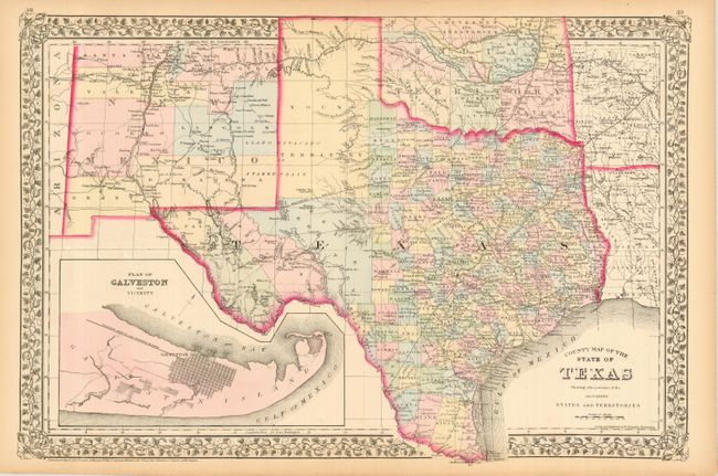
This fine double-page map of Texas extends to include most of New Mexico to above Santa Fe and the adjoining parts of Oklahoma, Arkansas and Louisiana. The map presents an excellent view of the county development with only the large regions of West Texas yet to be organized. Galveston’s role as a main port of entry is obvious as it is depicted in a large inset. The Llano Estacado, or Staked Plain, is shown extending from the New Mexico Territory through the Texas panhandle. Numerous railroads serve the southeastern part of the state with the future Southern Pacific R.R. shown as a dotted line from Dallas heading west toward California. Indian Territory is divided into several large Indian nations and reservations. The map is surrounded by Mitchell's distinctive grapevine border. Drawn and engraved in Philadelphia by W. H. Gamble.
References:
Condition: A
A little light marginal toning, else fine.