Catalog Archive
Auction 116, Lot 309
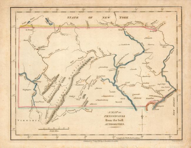
"A Map of Pennsylvania from the best Authorities", Stockdale, John
Subject: Pennsylvania
Period: 1794 (dated)
Publication: The American Geography
Color: Hand Color
Size:
9 x 7.3 inches
22.9 x 18.5 cm
Download High Resolution Image
(or just click on image to launch the Zoom viewer)
(or just click on image to launch the Zoom viewer)