Subject: Michigan
Period: 1847 (circa)
Publication:
Color: Hand Color
Size:
39 x 25.7 inches
99.1 x 65.3 cm
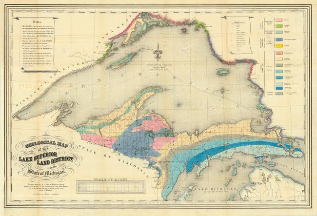
A striking map that shows the geology of the Upper Michigan Peninsula, Isle Royale and the north shore of Lake Superior and indicates copper, iron, silver, marble furnaces, iron forages and active/inactive mines. It was prepared by J.W. Foster & J.D. Whitney pursuant to an Act of Congress approved March 1, 1847 entitled "Act to establish a new land District for the sale of mineral lands in the State of Michigan." There is a color code explanation in the upper right and beautiful fleur-de-lys at center. A handsome map with fine original hand coloring to indicate 13 different geological formations.
References:
Condition: B
Fine, strong coloring and dark impression. Issued folding, now pressed and backed with archival tissue. Light text offsetting mostly in upper portion, else very good.