Subject: Maine
Period: 1842 (published)
Publication: A New Universal Atlas
Color: Hand Color
Size:
10.8 x 12.5 inches
27.4 x 31.8 cm
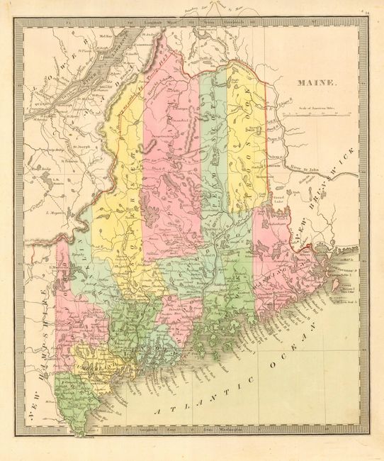
Maps by Greenleaf are uncommon and are highly sought after, but the map of Maine is of special interest. Greenleaf, a resident of Bangor, as a land developer was frustrated by the lack of a good, detailed map of the interior of Maine. Deciding to produce one, he spent every spare moment for six years collecting data for the proposed map. In 1815 he published Map of the District of Maine from the latest and best Authorities. Recognizing the limited value of a map produced from historical information, he set out to survey the entire state to create "a perfect map of Maine" with profits from his map sales. In 1820, the year of statehood, Greenleaf published the revised Map of the State of Maine. A state historian said of Greenleaf that he "did more than any other man to make known ... the value and importance of Maine…" This handsome map is Greenleaf's atlas map of the state, detailing the roads, towns and villages, ports, watershed and more. Very little is known about the history and editions of Greenleaf's atlases, but this map is reportedly from the 1842 edition.
References: Ristow pp.94-96.
Condition: A
Near fine example with fine coloring, crisp impression and full margins. Just a trace of foxing or toning in the blank ocean.