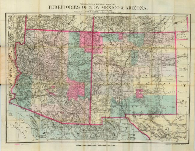
Subject: Southwestern United States
Period: 1881 (dated)
Publication:
Color: Hand Color
Size:
28 x 19.6 inches
71.1 x 49.8 cm
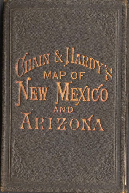
This rare and highly desirable map was produced by the Denver firm of Chain & Hardy. The pocket map is fully and finely engraved with remarkable detail throughout. The map extends to show a good portion of southern Colorado and Utah, to above Silver City and Cedar City. Folding into brown cloth covers with gilt and embossed titling, the paper label inside lists other products available; Colorado view albums, Morrison's Mining Rights, Colorado Reports, the photographs of William Henry Jackson, Nell's Topographical & Township Map of Colorado, and another Nell's map of central and southwestern Colorado. The firm's address is given at 414 Larimer Str., Denver.
References:
Condition: B
Very fine color and impression on fine watermarked banknote paper with full margins. Some fold intersection splits and one short split at margin cleanly into map, all easily repaired. Cover is in very good condition as well.