Subject: World & Continents
Period: 1634 (published)
Publication: Atlas Minor
Color: Hand Color
Size:
8 x 5.6 inches
20.3 x 14.2 cm
Jan Jansson engaged Abraham Goos, one of the most accomplished engravers of the day, to create these plates for his continuation of the Mercator pocket atlas. This interesting set, from a Latin edition, is illustrative of the fluctuating theories prevalent during this period of discovery.
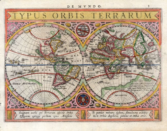
1) "Typus Orbis Terrarum" is a beautiful double hemisphere world map surrounded in strapwork borders into which are set an armillary sphere and a compass rose. The map features the island of California with no coastline continuing to the northwest. Terra Australis has a broken coastline and a notation that ends with the signature of the engraver, A. Goos. Four lines of Latin text balance the title cartouche at bottom.
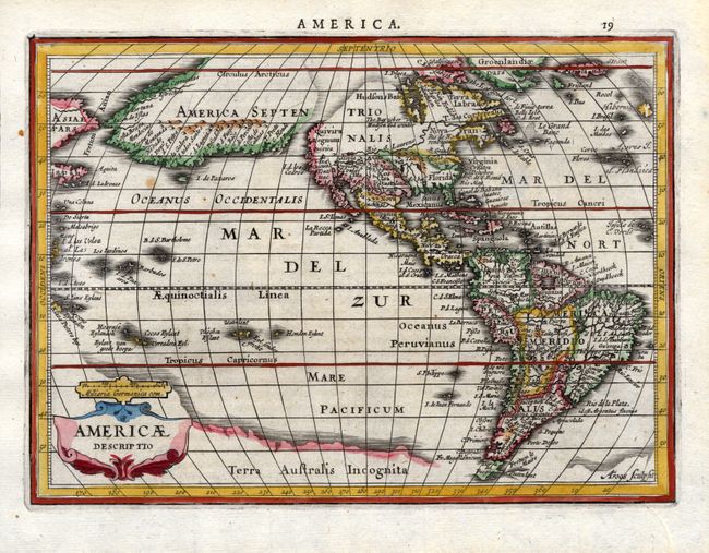
2) The most dominant feature of "Americae Descriptio" is the curious depiction of the west coast of North America, which is completely bisected by an unnamed straight (Northwest Passage), possibly derived from reports of Juan de Fuca's disputed voyage. The bulging northwest coast of North America continues another 65 degrees and is separated from Asia by a narrow Fretum Anian. These features were derived from the Van den Keere and Plancius globe of 1614 and this is the first time they appear on a map of the Americas. Previous maps had depicted the supposed Northwest Passage through the Strait of Anian. Other interesting features include the St. Lawrence River flowing from a small lake in the west, no Great Lakes, and an area of shading in Virginia alluding to the possibility of a Verrazano-type inland sea.
3) "Asia," though also engraved by Goos, strongly resembles Pieter van den Keere's configuration with Japan on the Teixeira model and the long island of Korea.
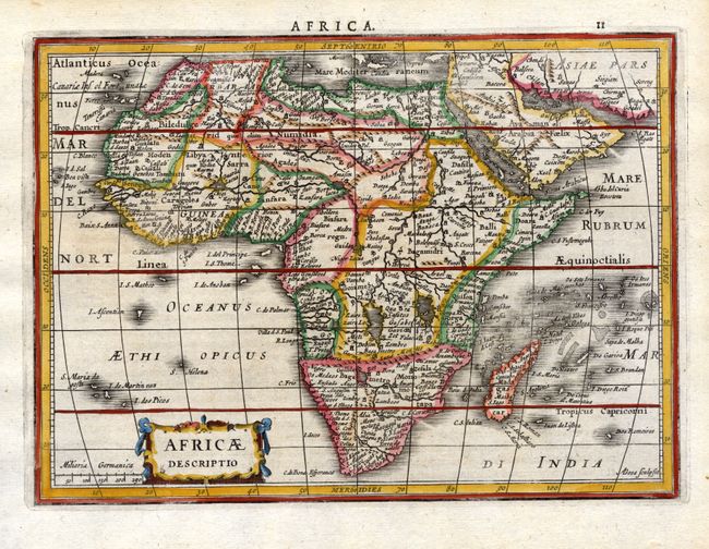
4) "Africae Descriptio" is based largely on the work of Henricus Hondius, with the typical antiquated geography of the sixteenth and early seventeenth centuries.
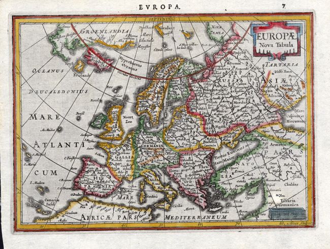
5) "Europae Nova Tabula" shows the discoveries of Willem Barents in his quest to find a Northeast Passage to Asia.
References: Shirley #325 (World); Burden #221 (America); Yeo #21 (Asia).
Condition: A+