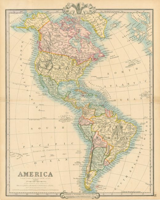
Subject: Western Hemisphere
Period: 1855 (circa)
Publication:
Color: Hand Color
Size:
13.8 x 17.5 inches
35.1 x 44.5 cm
This attractive mid-nineteenth century map of North and South America is colored by country and contains nice topographical and hydrographical information. In the United States the large western territories of Oregon, Utah, and New Mexico are delineated, and the border with Mexico shows it is after the Gadsden Purchase of 1854. Just under the title is a note that the Americas had a population of 60 million, with only four people per square mile.
References:
Condition: B
Original hand coloring. The map has archival tape repairs of short fold separations and some tears entering the border.