Catalog Archive
Auction 115, Lot 628

"Estats del'Empire du Grand Seigneur des Turcs, en Europe, en Asie, et en Afrique", Jaillot/Ottens

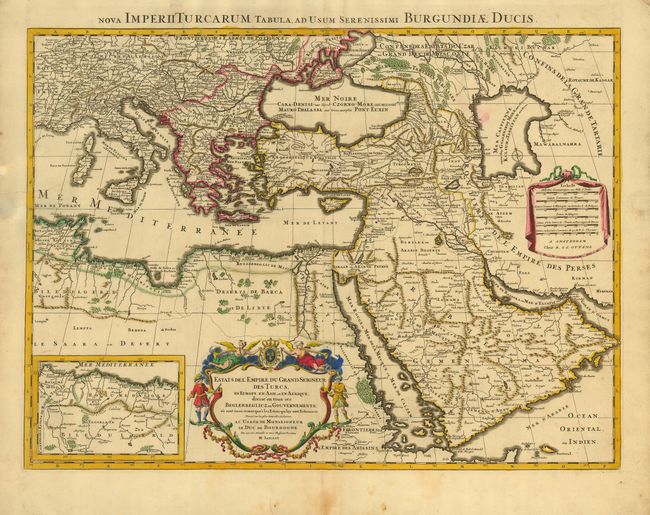
Subject: Eastern Mediterranean, Near and Middle East

Period: 1730 (circa)

Publication:

Color: Hand Color

Size:
23.8 x 17.5 inches
60.5 x 44.5 cm
Download High Resolution Image
(or just click on image to launch the Zoom viewer)

A large, decorative map of the Turkish Empire, covers territories in the Balkans, Anatolia, Levant, North Africa and Arabia. The map includes an inset of the eastern most provinces in North Africa. It is embellished with a drape-style distance scale cartouche and a large title cartouche decorated by angels, soldiers and the royal French arms. Published by Reiner and Joshua Ottens.

References:

Condition: B

Original outline color with slight oxidation. Added color in cartouches. Small smudge of color in map and some minor marginal defects.

Estimate: $350 - $400

Sold for: $250

Closed on 6/21/2006

Archived