Subject: Cartographic Miscellany
Period: 1815-50
Publication:
Color:
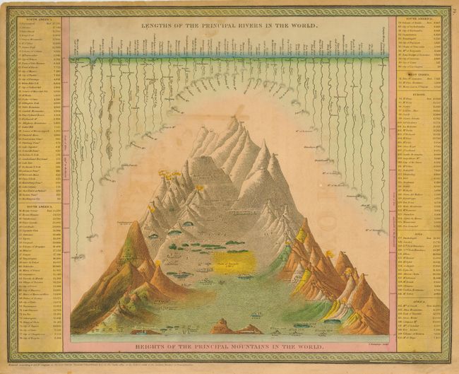
1) This is an interesting comparative chart with the mountains and volcanoes at center and the rivers at the top. Major world cities are shown scattered across the mountains at their appropriate elevations. Text key at sides gives mountain heights by continent. This lovely sheet is the frontispiece for Mitchell's New Universal Atlas, published by Thomas, Cowperthwait & Co., in 1850, hand colored. (16 x 12.8")
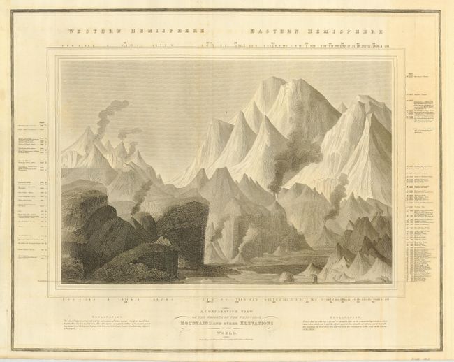
2) This great chart was engraved by the famous firm of W. & D. Lizars for Thomson's New General Atlas. Drawn in a landscape composition it depicts the mountains, volcanoes, plateaus and sea shores of the world. The view is placed in an engraved picture frame border that is surrounded with text describing the various regions. Black and white, 24.5 x 19.5" with text, circa 1815.
References:
Condition: B
The former has some offsetting from the title page and a little age toning, else very good. The latter is very good with just a hint of toning in blank areas.