Catalog Archive
Auction 115, Lot 367

"Fol E - Fig. XIII", Scherer, Heinrich

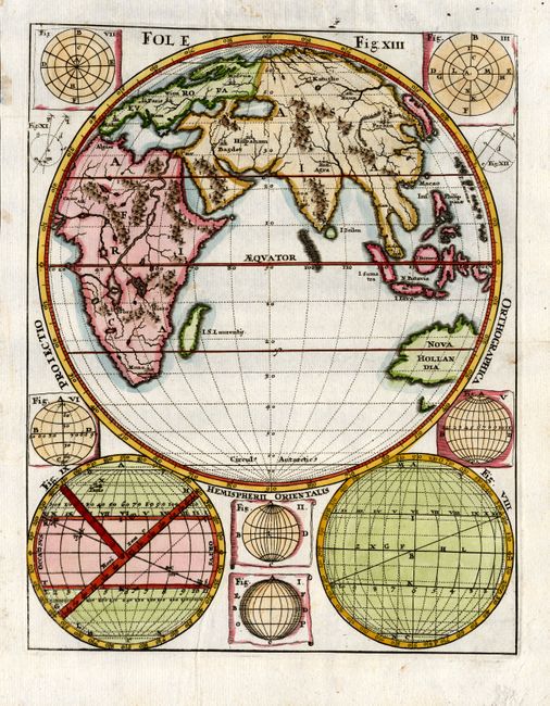
Subject: Eastern Hemisphere

Period: 1710 (published)

Publication: Atlas Novus

Color: Hand Color

Size:
7.3 x 9.2 inches
18.5 x 23.4 cm
Download High Resolution Image
(or just click on image to launch the Zoom viewer)

This interesting chart is from Scherer's geographical compendium and contains a map of the Eastern Hemisphere with emphasis on topography, only a few cities are located. Australia (Nova Hollandia) is partially shown with only the southern tip of Tasmania delineated. Africa is shown with the Ptolemaic twin lakes source of all the major rivers on the continent. The sphere is surrounded with a variety of diagrams.

References:

Condition: A+

Estimate: $140 - $180

Sold for: $120

Closed on 6/21/2006

Archived