Subject: Hispaniola
Period: 1806 (dated)
Publication:
Color: Black & White
Size:
28.7 x 18 inches
72.9 x 45.7 cm
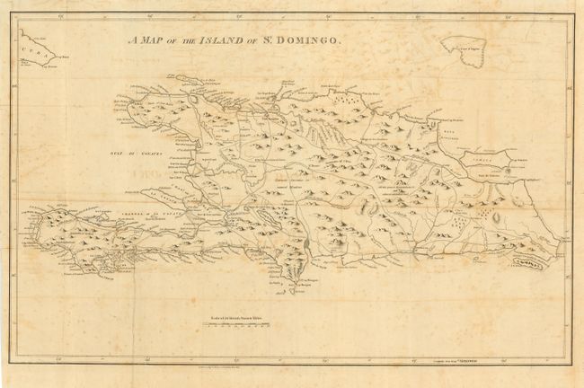
An interesting map of the island made during the troublesome time of establishing independence from Spanish and French control. The map does not reflect the declaration of independence of Haiti proclaimed in 1800, nor the French departure in 1803. A public road system is clearly marked and hydrology is well developed. The illustration of topography has yet to achieve a degree of sophistication, but place name detail is good and reflects the French and Spanish influence. Distance scale uses British Statue Miles.
References:
Condition: B
Issued folding, now pressed and backed with archival tissue. Generally scattered foxing and some offsetting.