Catalog Archive
Auction 115, Lot 265

"Map of the State of New York Compiled by the Latest Authorities", Thomas, Cowperthwait & Co.
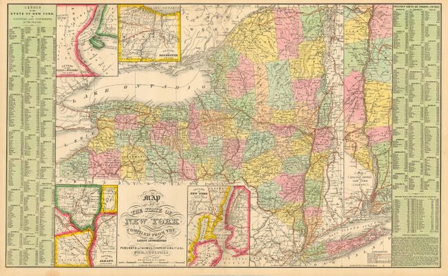
Subject: New York

Period: 1854 (published)

Publication:

Color: Hand Color

Size:
26.3 x 16 inches
66.8 x 40.6 cm
Download High Resolution Image
(or just click on image to launch the Zoom viewer)

Large double page map of the state with much information. Sheet includes five large insets: Rochester, Albany, Niagara Falls, vicinity of New York, and a long inset detailing the course of the Hudson River from Albany to New York Bay. At both sides are County statistical tables that include the major towns with populations from the 1850 Census.

References:

Condition: A+

Sharp impression with fine, original hand coloring.

Estimate: $100 - $120

Sold for: $75

Closed on 6/21/2006

Archived