Catalog Archive
Auction 115, Lot 219

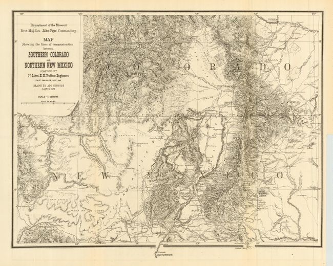
"Map Showing the lines of communication between Southern Colorado and Northern New Mexico", Ruffner, Lt. E.H.
Subject: Colorado and New Mexico

Period: 1876 (dated)

Publication: U.S. War Department

Color: Black & White

Size:
18.5 x 14 inches
47 x 35.6 cm
Download High Resolution Image
(or just click on image to launch the Zoom viewer)

The region from Pueblo to Albuquerque and Fort Defiance to just east of Trinidad is shown. Santa Fe, Taos, Fort Garland, Fort Wingate, Las Vegas, Trinidad and Pueblo are named, with detailed topography, as well as roads, towns, watering holes, pueblos and much more. The map was issued at the conclusion of Ruffner's 1873 expedition into Ute Country to quell the unrest between the Ute Indians and the prospectors in the newly discovered San Juan Mining Region. It is a scarce map, full of information not found elsewhere.

References:

Condition: A

Near fine example is clean and bright with full, original margins. Trace of offsetting in lower margins, else fine.

Estimate: $150 - $200

Sold for: $100

Closed on 6/21/2006

Archived