Subject: Utah and Nevada
Period: 1865 (dated)
Publication:
Color: Hand Color
Size:
13.8 x 11.5 inches
35.1 x 29.2 cm
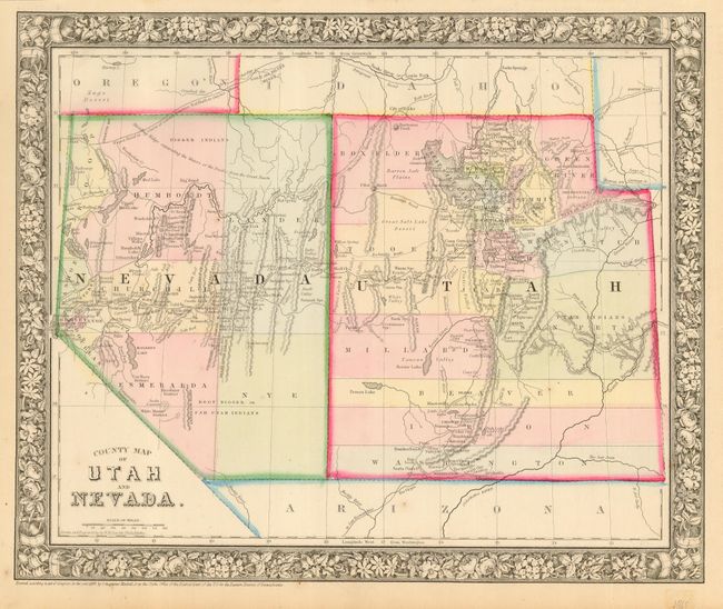
Very nice sheet with good detail in an early state showing a wide Utah and Nevada without the southern tip which belongs to Arizona Territory. The 1865 issue of this atlas is less often seen. The map does not show the railroad. Delineates the Emigrant Road to California, a portion of the Emigrant Road to Oregon, the under construction wagon road from Red Bluffs to the Owyhee mines, and the Hastings Road across Utah. Locates Indian tribes, gold and silver mines, the Telegraph route, Lake Tahoe, and much more. Decorative grapevine border similar to first edition. A lovely example of this map.
References:
Condition: A+
Fine impression and original color with full margins. One small spot in blank and uncolored Arizona Territory.