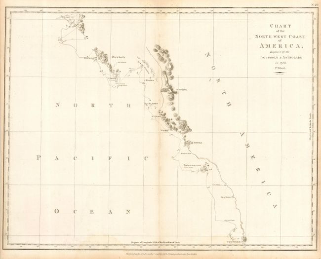
"Chart of the North west Coast of America, Explored by the Boussole & Astrolabe in 1786. 2d. Sheet", La Perouse, Comte Jean F. Galoup, de
Subject: Western Canada & United States
Period: 1798 (dated)
Publication: Voyages of La Perouse…
Color: Black & White
Size:
19.5 x 15 inches
49.5 x 38.1 cm
This sheet covers the coastline of Washington and British Columbia from Cape Redondo (possibly Tillamook Head) north to B. de Clonard, probably on the Queen Charlotte Islands. Area includes Nootka (Vancouver Island), Woode Pt., B. St. Louis, C. Fleurieu, C. Hector, and Be. De la Touche and names Mt. Fleurieu and Mt. De la Touche. The ship's course is detailed by numbered days, showing soundings, rocks and islands along the way. From the English edition, published just two years after the French edition. Professionally encapsulated in archival Mylar.
References: Phillips (A) 693; Wagner #844
Condition: B
Original margins and fine impression. Centerfold toning, else very good.