Subject: North America
Period: 1844 (circa)
Publication: A New General Atlas
Color: Hand Color
Size:
10 x 14.8 inches
25.4 x 37.6 cm
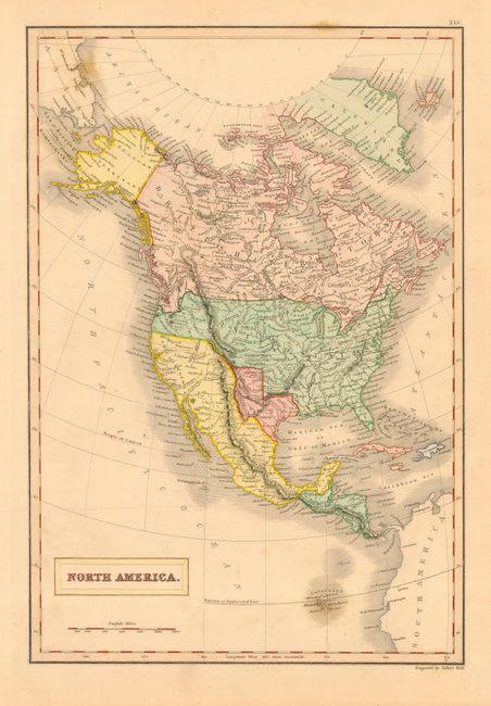
This beautifully engraved chart features the Independent Republic of Texas with the 'stove pipe' reaching to the 40th parallel. Map extends to include Cuba, Jamaica, St. Domingo, and all of Central America. As a British mapmaker, Hall extends Canada well south to the Columbia River in the Pacific Northwest. Alaska is still Russian Territory and Mexico occupies California and the Southwest. The states and provinces are not delineated, but some regions are labeled including Western Territory in the area of present-day British Columbia, Washington and Oregon. East of the Rockies the huge area is largely unnamed except for Dakoutas and many rivers. The map is filled with place names including Indian villages. Surrounded in a bold keyboard style border.
References:
Condition: A
Very nice original coloring and fine impression with full margins. One foxing spot at upper border and a few hints of foxing in the blank ocean, still very good.