Subject: Italy
Period: 1566 (dated)
Publication:
Color: Black & White
Size:
8.3 x 7 inches
21.1 x 17.8 cm
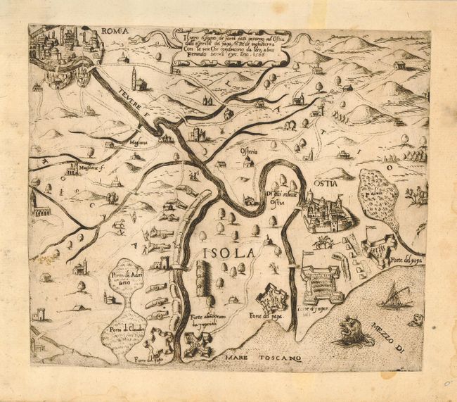
A very scarce copper engraved map from a 16th century Italian atlas of the Lafreri-School. The map focuses on the region between Rome and Ostia with specific emphasis on the fortifications around Ostia. Blank on verso.
The Lafreri-School was not actually a school, but a group of cartographers, mapmakers, engravers and publishers who worked in the major Italian publishing centers of Rome and Venice, from about 1544 to 1585. Originally these publishers issued maps as separate sheets and there was no standardization of size. When they started to sell the maps in bound collections the lack of size uniformity caused considerable problems for the binder. Some maps had to be folded while the smaller maps had to be enlarged by means of having margins added so they could be bound in a volume of uniform size. One of the largest publishers in Venice during this period was the Bertelli family, of which Ferrando Bertelli was the most active. Many of the maps published by Ferrando were drawn or engraved by Paolo Forlani.
References:
Condition: A
Very dark impression. Trimmed to neatline with margins added as is common with maps from the Lafreri atlases. Damp stains and small holes in margins.