Subject: France
Period: 1761 (dated)
Publication:
Color: Black & White
Size:
34.3 x 23 inches
87.1 x 58.4 cm
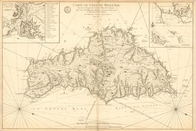
Large and strongly engraved chart with remarkable detail of the island and its complex coastline. Details include towns and villages, roads and trails, military batteries, forts, topography, and more. Shows a windmill near Lomaria. Locates le Palais, la Citadelle, la Grand Village, Bornord, Querelle, Sauzon, and a score of others. Two large insets: "Plan du Bourg Havre et Citadelle de Belle-Isle" and an untitled chart of Belle-Isle and the coastline of Brittany to the northeast that also shows the small islands of Hoedic and Houat. Rhumb lines and fleur-de-lys. The chart was prepared by Jacques Nicolas Bellin for M. Berryer. An uncommon issue.
References:
Condition: B
Strong, dark impression on thick hand laid paper. Large plate that left only about 1/2" margins, as issued. Light toning along centerfold and at edge of some margins, else very good.