Catalog Archive
Auction 114, Lot 306

"Indiarum Occidentalium Tractus Littorales cum Insulis Caribicis ... Pascaert van Westindien ende Caribise Eylanden", Wit, Frederick de
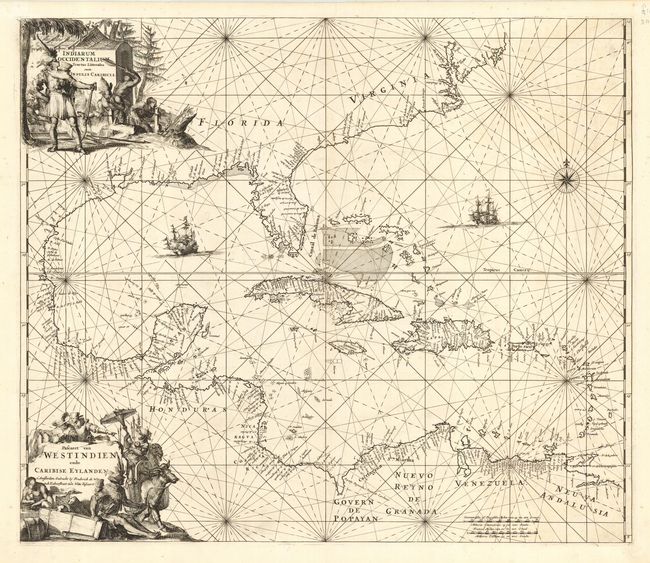
Subject: Caribbean

Period: 1680 (circa)

Publication: Orbis Maritimus ofte Zee Atlas

Color: Black & White

Size:
22.5 x 19.3 inches
57.2 x 49 cm
Download High Resolution Image
(or just click on image to launch the Zoom viewer)

This is one of the most beautifully engraved maps of the West Indies. It extends to show the coastline of North America nearly to New England. There is a wealth of navigational information including sandbanks and shoals. The chart is a masterpiece of decorative engraving with illustrations of sailing vessels, a compass rose and two elaborate title cartouches (Latin and Dutch), one showing cannibalism.

References: Burden #468.

Condition: A

Superb impression. Professional and near invisible repair of tear just to the right of centerfold.

Estimate: $2,300 - $2,750

Sold for: $2,000

Closed on 3/1/2006

Archived