Subject: Virginia
Period: 1834 (dated)
Publication: A New Universal Atlas
Color: Hand Color
Size:
12.8 x 10.3 inches
32.5 x 26.2 cm
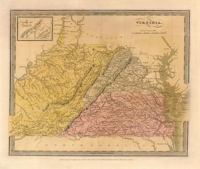
An interesting and uncommon state map covering present-day Virginia and West Virginia. David H. Burr was one of the most important American cartographers of the first part of the nineteenth century. He was topographer to the U.S. Post Office and later was geographer to the House of Representatives. The map shows topography, counties, cities, towns and roads. Burr's access to information from the postal service is evident in the accuracy of the road system depicted. It is colored into four large regions, the purpose of which we are not able to determine. The southwestern corner is included in an inset at top - The Western Part of Virginia. Burr was unable to complete the project for the Universal Atlas before his postal service appointment, so the atlas was completed by Illman and Pilbrow and issued in 1835.
References: Ristow p. 106.
Condition: B
Toned with faded color; the two regions in the west appearing nearly the same color now. Minor edge tear repaired with tissue.